Travels with Dick and Karen
Iceland, June 2016
During preparations for our last three trips abroad (Driving Around the UK, a month in Paris, London: scroll down the travel page if you want to read those), we've discussed taking advantage of Iceland Air's offer of a "free" multi-day stopover in Iceland.
|
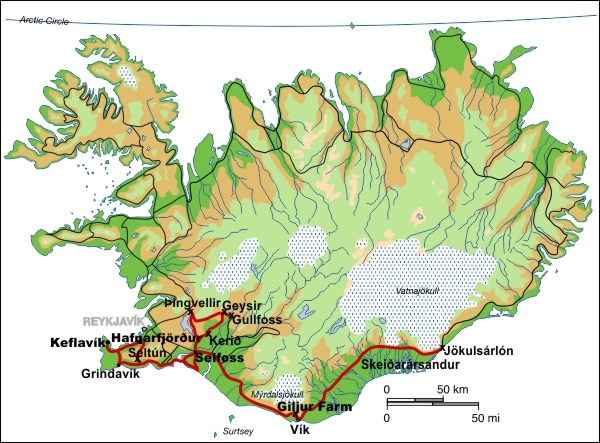
(Map altered from one by Max Naylor and used with permission) |
| We felt we'd be able to survive an extra week at the end of our London sojurn, so we did it. Icelandic's fares are a bit higher than the other carriers, so "free" did have its costs. |
 |
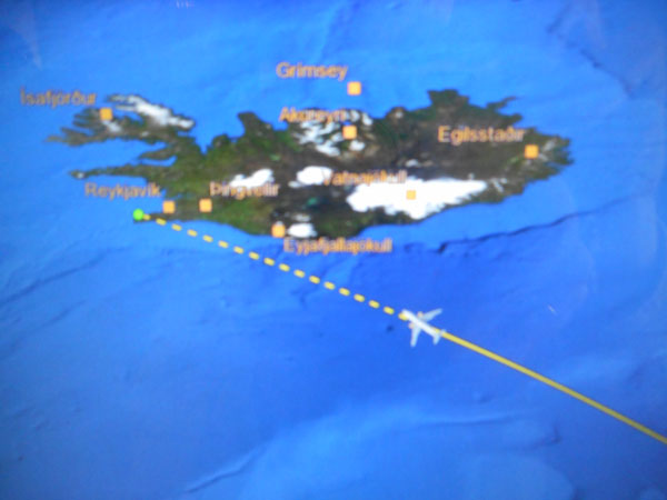
Approaching Iceland as shown by the seat-back map (blurry due to camera, not aircraft). We'd chosen right-side window seats to see the island on approach, but it was totally overcast. |
 |
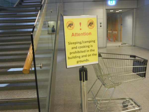
The signs in the Keflavik airport terminal are a bit different than those in most of the US. Since it's not also in Icelandic, we suspect it's purely aimed at tourists. |
 |
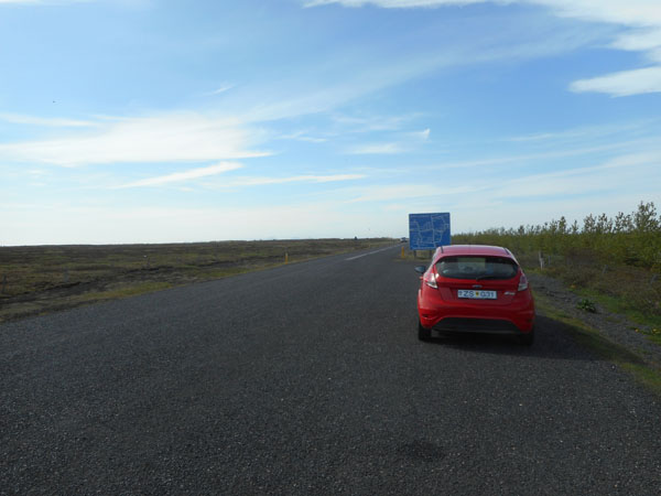
| As we landed, Dick thought that the airplane was displaced quite a bit off the runway's centerline. As we passed the windsock, it showed that we'd arrived with a 90 degree stiff crosswind. The plane parked at the gate with its tail pointed at the wind. The plane was continuously rocking as we disembarked, requiring a boat-to-dock-like timing to step onto the relatively stable jetway. It was blowing hard with horizontal rain when we landed, but the rain let up a bit by the time we'd picked up our car (a red Ford Fiesta) and bought a SIM for the phone. The wind was still quite strong.. |
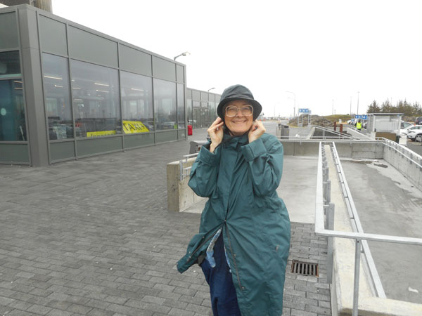 |
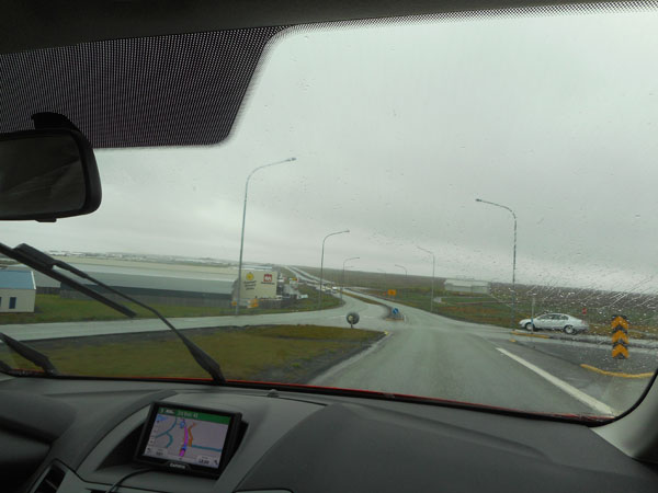
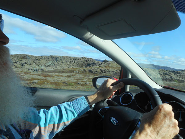
| It took a few circuits of the parking lot to find our way out of the aiport. Dick had to rapidly get re-used to driving after a month off, including remembering to switch his mind back to being on the right side of the road after being in England for that month. The 5-speed stick (only in the US and environs are automatics common) merely added to the occasional colorful language (and/or apologies to the car for what he was asking it to do in the wrong gear). Fords and VWs put "Reverse" on opposite sides of the quadrant. |
 |
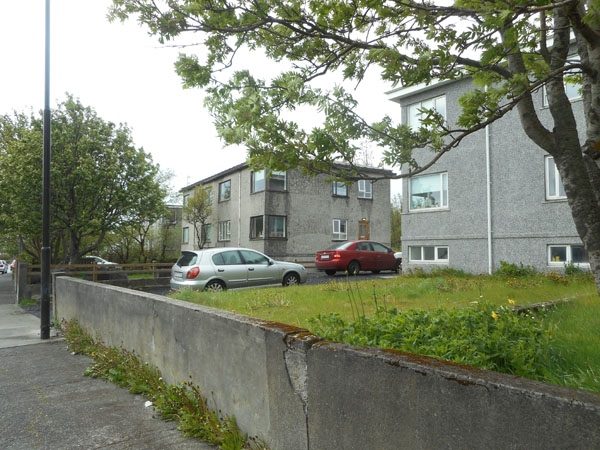
Our first Air B&B host was Vignur in the town of Hafnarfjörður about 40 minutes northeast of the airport along the coast. We occupied the entire top floor of his house. (If your screen shows strange characters in that town's name, be advised that Icelandic has not only accents and umlauts, but also a few totally unique characters in their alphabet. One (ð) looks like a backwards 6 and is kind'a pronounced "eth") |
 |
| It looked exactly as promised and was a great place to get out of the weather with lots of space to spread out and re-pack to extract our "Iceland" clothes. |
 |
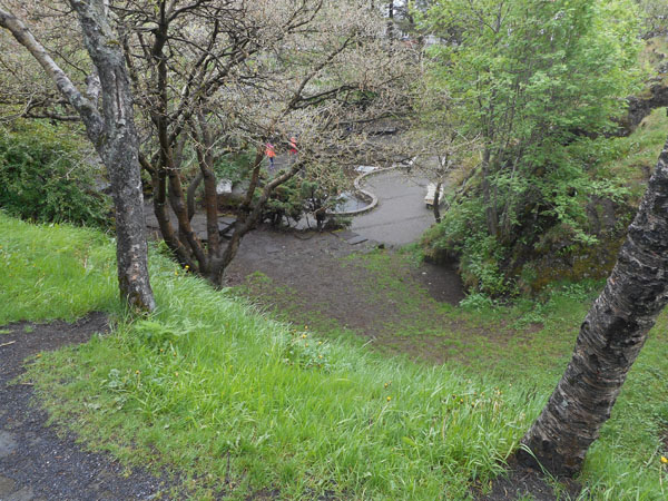
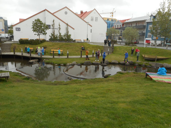
For our first morning, we stopped by the city park. |
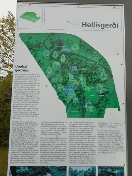 |
| Hafnarfjörður is known as the "city in the lava" and the buildings are placed in between lava outcrops. The park was a beautiful example (without buildings). |
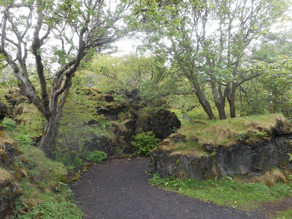 |
With more (and larger) trees than we saw at most other places. The park's gnarly landscape provided protected areas from the wind. |
 |
| Then we went down to the town's center for groceries |
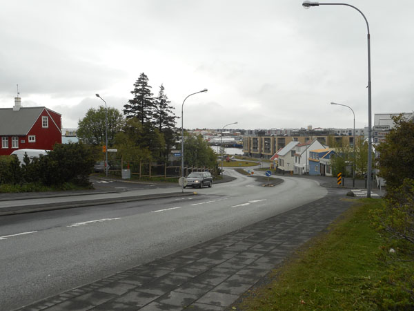 |
| This is downtown at one end of the shopping street. Moms and kids playing by the lake. The buildings are much more industrial than we are used to so that they can cope with the weather. The doorways usually have airlocks or windbreaks of some sort. |
 |
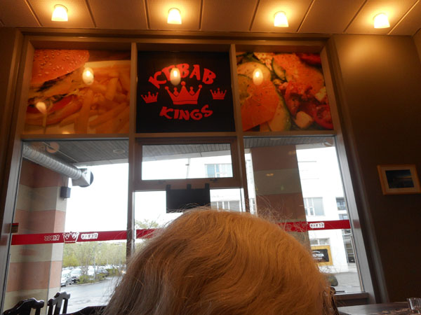
| We had lunch at the "Kebab Kings", run by an immigrant from Iran. Highly recommended: good food and a nice person. |
 |
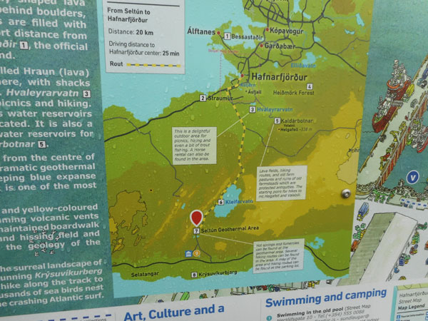
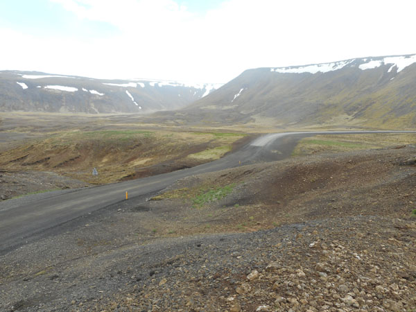
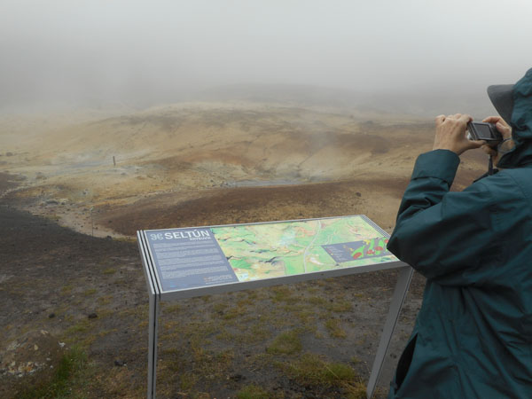
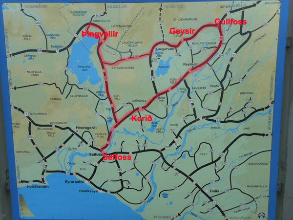
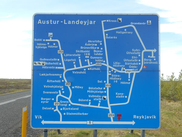
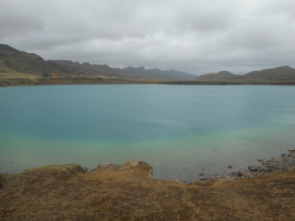
| Then we headed south out of town to cross the Reykjanes penninsula via the scenic dotted (and occasionally unpaved) road. Our immediate goal was to see the Seltún geothermal area. Our next two nights' stay will be in Selfoss near the south coast, just beyond the lower right edge of the map. Reykjavik, Iceland's capital city, is just beyond the top of this map. We never got there during our trip. Note the lake we'll be passing along the way. |
 |
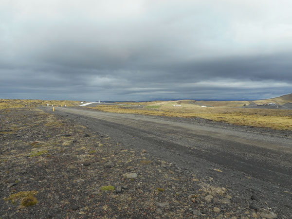
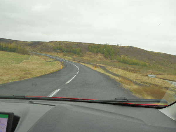
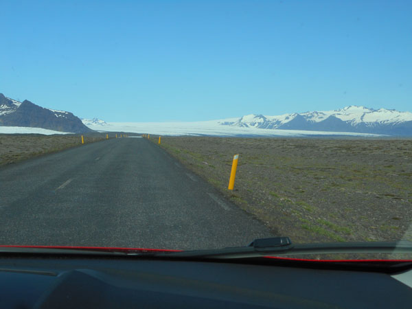
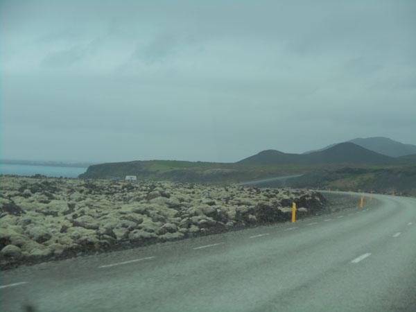
| It was a day of gray skies, but little wind or rain (usually). The pavement had ended just beyond that yellow post. |
 |
| The pavement permantently resumed after a stretch of geologically unstable ground. |
 |
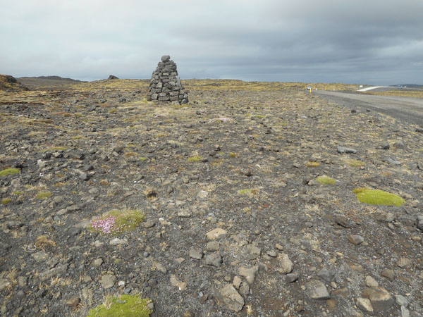
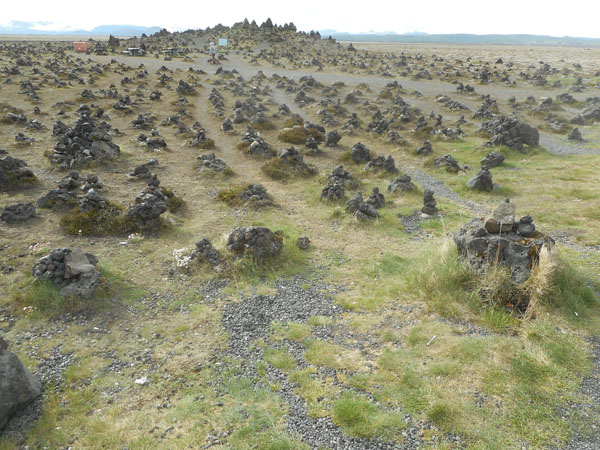
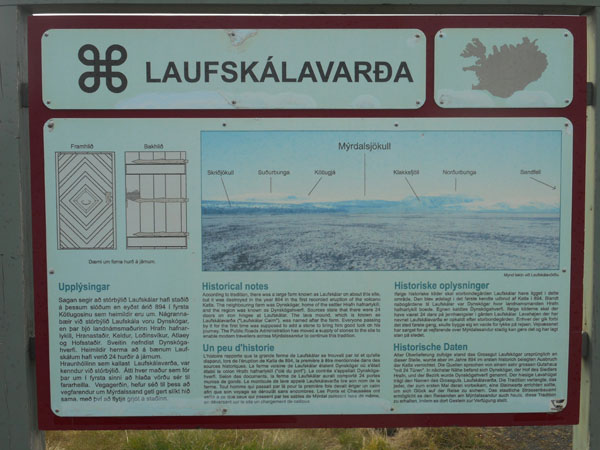
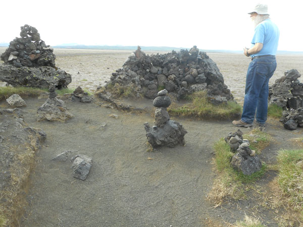
| Old cairns mark the way of old walking/horse tracks between farmsteads. There were signs requesting that one not add or remove stones from the cairns, thus preserving their historic state. |
 |
| In other places you can still see the actual trackway cuts remaining in the vegetation. |
 |
| In many places the vegetation was very alpine-looking: very small cushions of plant with tiny flowers. We both found this fascinating. |
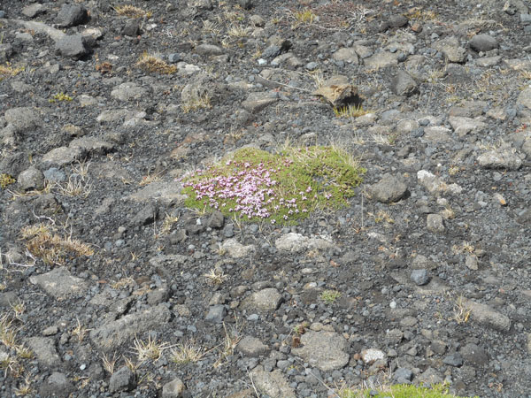 |
| (the brown rock on the lower left is about the size of a shoe's toe) |
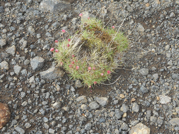 |
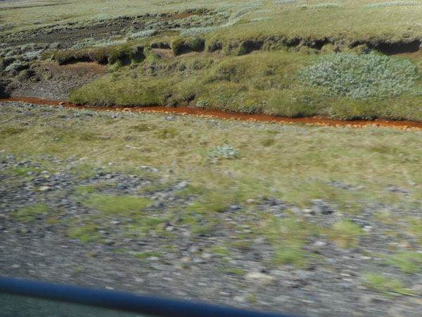
| In more sheltered areas there were mossy grasses and low shrubs: mostly lupine. |
 |
The fog lifted a bit and we could see the lake! Its shore had virtually no vegetation, |
 |
| but it did have interesting lava shapes |
 |
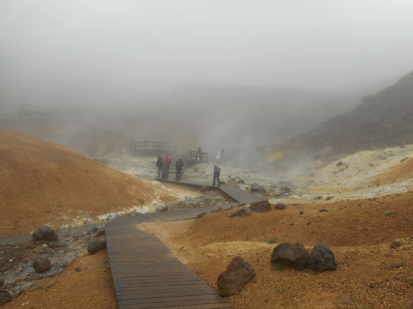
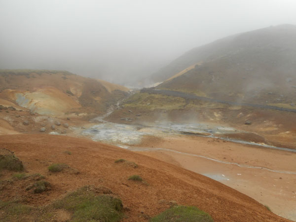
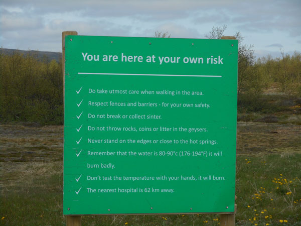
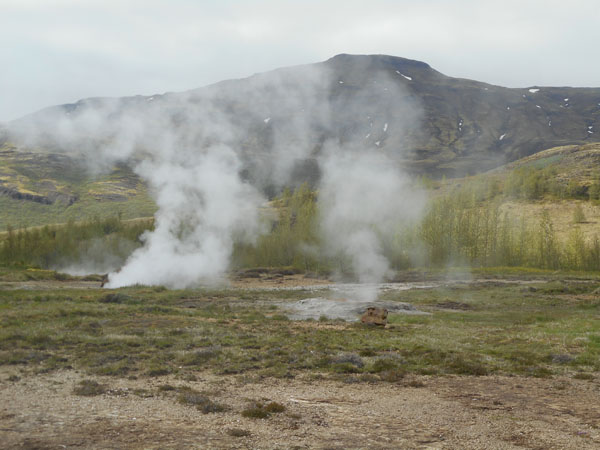
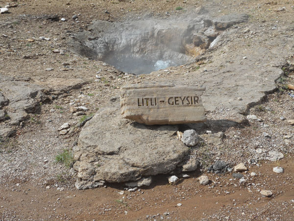
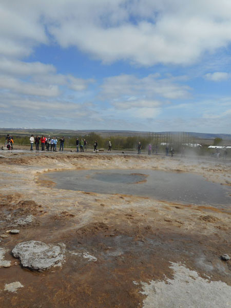
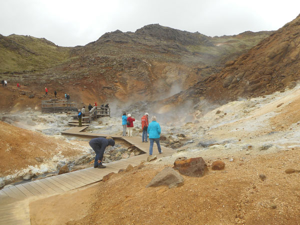
| The heavy fog disguised the geothermal steam of Seltún |
 |
| Walkways to keep us safely above the fragile (and very hot) crust |
 |
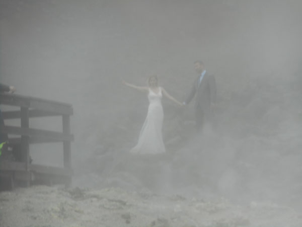
| But some folks were having a wedding photo-shoot |
 |
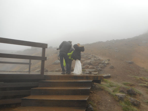
| And trying to stay warm between takes. |
 |
| There were trails that wandered up to the top of the ridge behind the pools. We opted out. |
 |
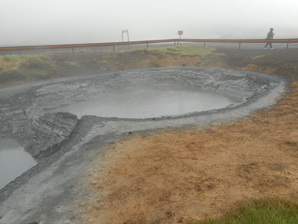
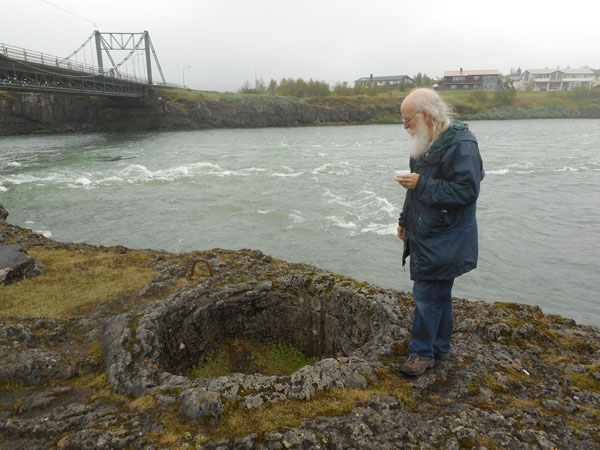
Across the street was a pair of sinkholes |
 |
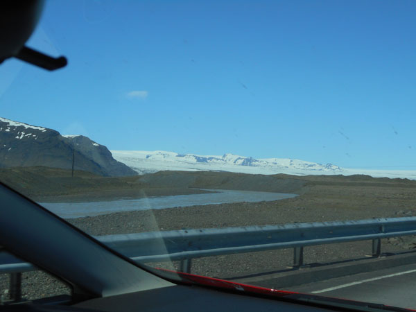
We reached the southern shore of the Reykjanes peninsula, and followed it westward. Occasionally the North Atlantic appeared. |
 |
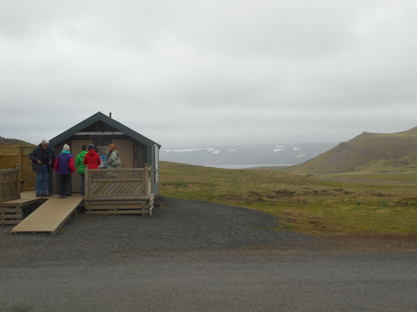
Our next two nights would be in this Air B&B find, a cozy studio newly-converted from a garage by the friendly host family. |
 |
After unpacking we went for a walk around the center of Selfoss. The bridge over the Ölfusá was Iceland's first suspension bridge, built in 1891. Unfortunately it was designed in the horse-and-wagon era and collapsed when two heavy milk trucks were on it in 1944. The current heftier replacement was put up before the end of 1945.
Dick is peering into the interesting lava formations along the river bank while eating the best ice cream of the trip. |
 |
| The next morning we set out along Iceland's famed "Golden Circle" |
 |
Again the pattern of moss and grass with a few low, scubby trees in shelered places.
Dick was "enjoying"(?) his usual view of the scenery (freshly painted) and the narrowness of the Ford Fiesta compared to a VW camper. |
 |
| We soon reached delightfully tortured terrain. |
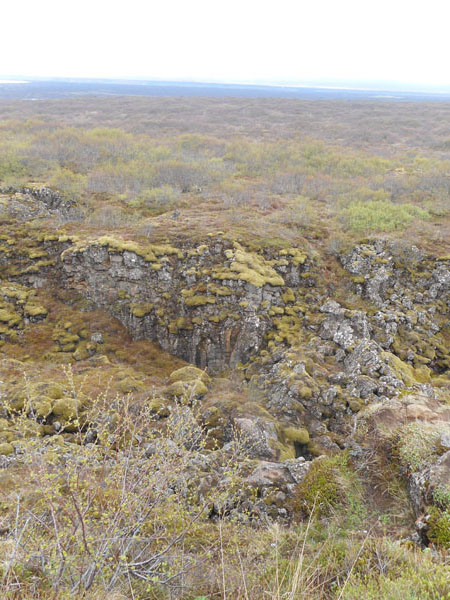 |
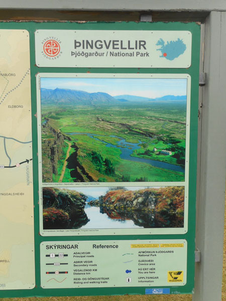
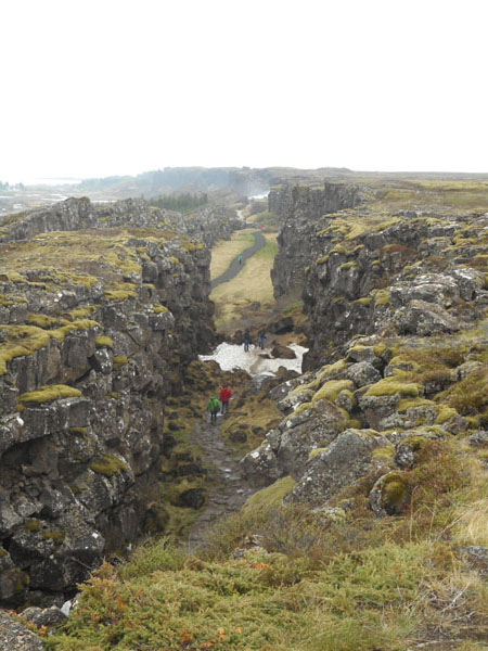
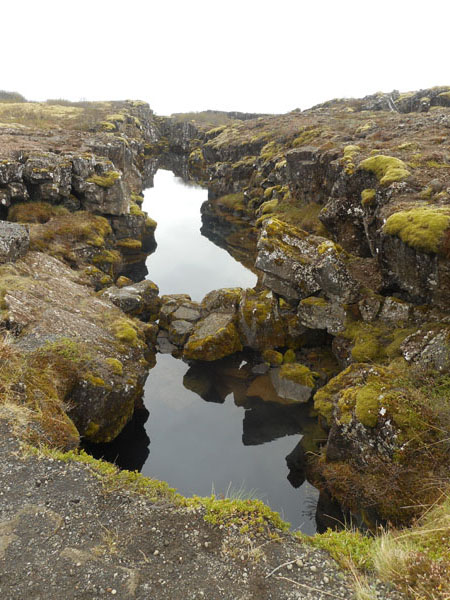
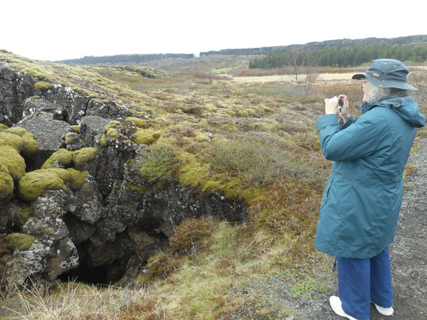
Our first stop is þingvellir (the first letter is sort of a th sound). This is the historic location of Iceland's early democracy as the location of its Parliment gatherings starting in 930.
It's also the active crest of the Mid-Atlantic Ridge... this is part of the ridge where the spreading apart of the North American and Eurasian continental plates happens. |
 |
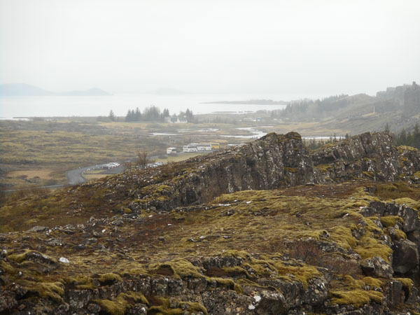
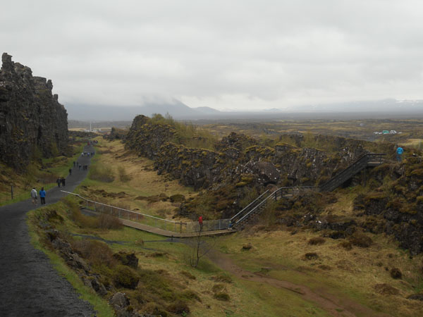
| Lake þingvallavatn in the distance. We're standing on the edge of the Almannagjá chasm, the largest and most dramatic evidence of the rift in the area but not the only one. |
 |
| The continental plates are drifting ... and they pull and rip the land apart that lies between them. |
 |
| Lots of lava has risen through the weakened crust to the surface and cooled. |
 |
| Although it's early June it's still spring here, with a snowfield covering part of the path. |
 |
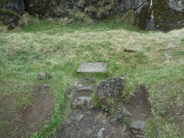
| The Almannagiá chasm is the historic site of the Iclandic combined legislature and law court (since relocated to Reykjavík). Booths of the chieftains were set up here. |
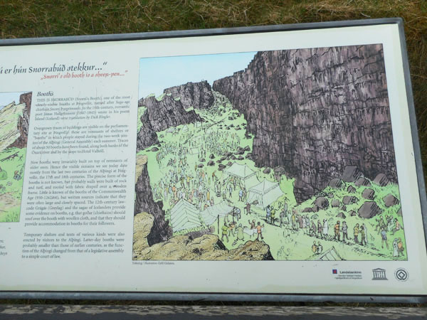 |
| and the foundations of the booths can still be seen |
 |
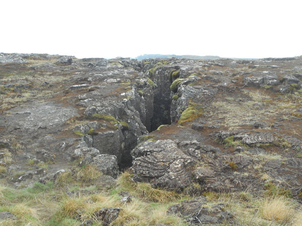
| Earthquakes are common and the valley has dropped at least 3 ft. since those times.
The rift is spreading about 7mm (1/4 inch) per year, and the floor of the chasm is dropping at the rate of 1mm (1/25th inch) per year. The tall cliff on the left of the photo can be considered as the Eastern edge of the North American Plate. |
 |
| The Öxará River falls into the chasm and spills out into the lower valley. There is evidence that the Icelanders rerouted the stream to get the water where they wanted it for their enclave. |
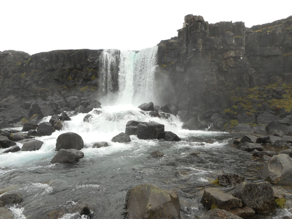 |
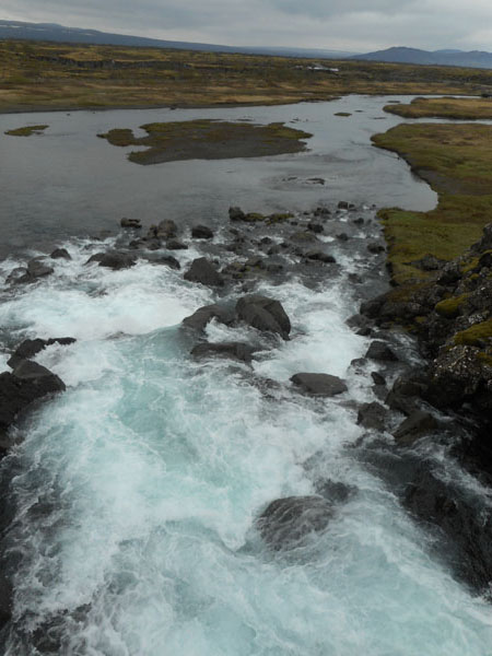
| The water has a rough ride through the tumble... |
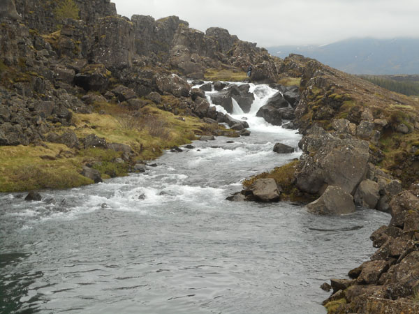 |
| .. then smooths out when it gets to the lake's level. |
 |
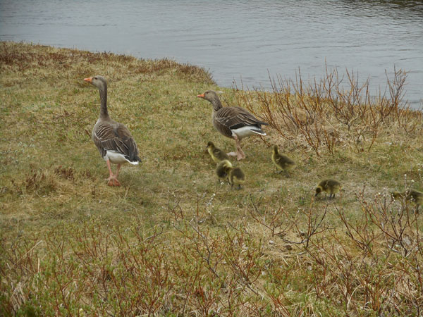
| Where we saw several families of geese |
 |
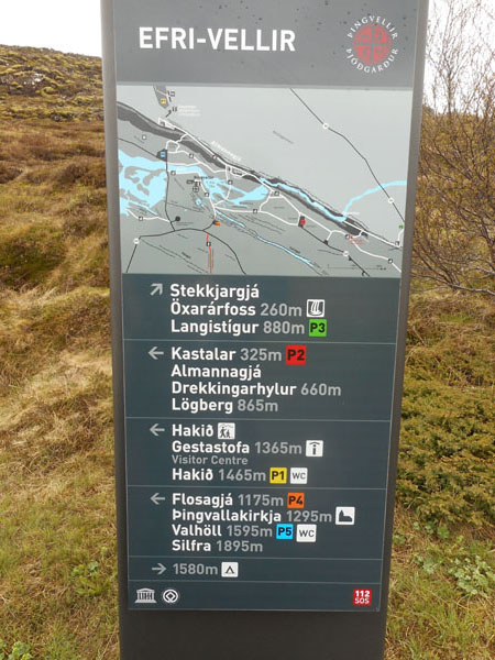
| Signage was fairly clear. Our car's GPS was in English but had an Icelandic keypad so we could tell it the correct place (once we figured out where all those unfamiliar letters were hidden). The suffix "foss" means "waterfall", so we'd usually go that-a-way. |
 |
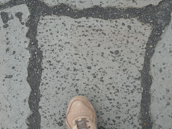
| Karen was very impressed by the paving around the visitor's center |
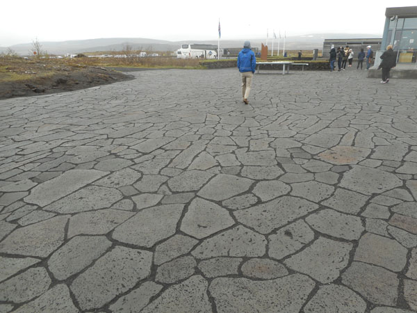 |
| Lava boulders had been sawn into paving stones. Envy. |
 |
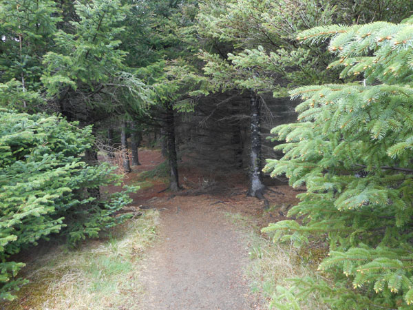
| Dropping down to the plain beneath the cliffs, we took a few of the hiking trails. In the shelter of the cliffs we came across one of the few real forests we saw during the trip. |
 |
| There were several other smaller chasms, many with water and beautiful refections. |
 |
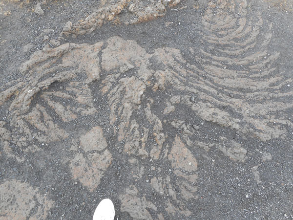
| ... plus various interesting holes. Local lore says some of these are the home of elves. |
 |
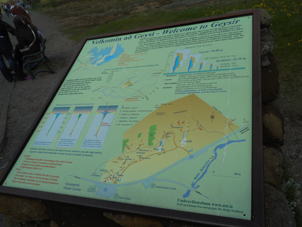
Back in the car, we set off westward towards the Geysir geothermal area (yes, this is the place that gave us the word "geyser" for hot water being thrown skyward). After a short session of map-confusion (the Michelin map had an intersection misplaced, our GPS wanted us to stay on the "main" road, and our druthers were to explore), we sorted it out.
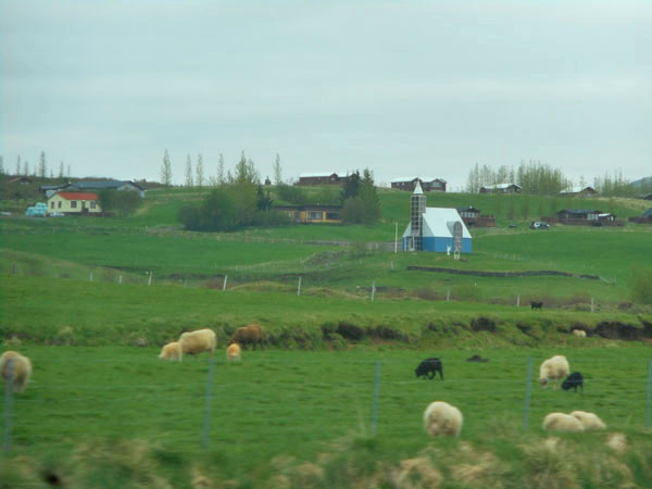
Exploring took us past cute churches and sheep. |
 |
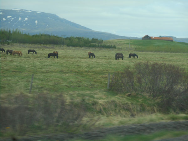
| And shaggy Icelandic horses grazing (these are kept as a special breed: you can't bring horses to Iceland and if you export a horse you can't bring it back into the country). |
 |
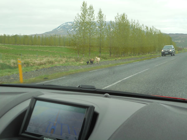
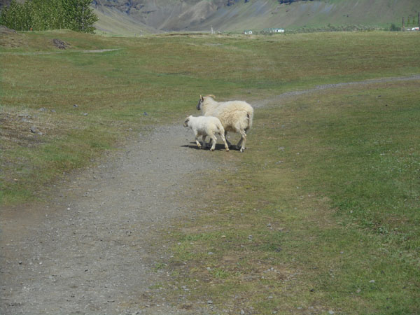
| typical road hazards (the oncoming car has almost completely stopped... at least one sheep will cross the road as you approach) |
 |
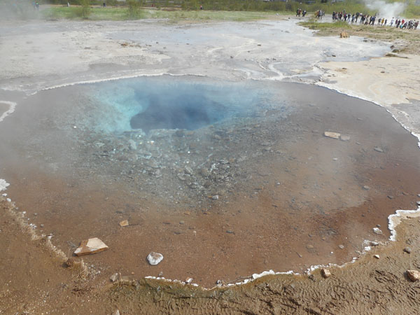
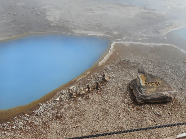
| The actual Geysir Reserve area is fairly small ... roughly 1/2 mile by 1/4 mile. |
 |
| |
 |
| Small, but dense with geothermal pools and geysers. |
 |
| Most with a name tag... |
 |
| We could get quite close ... less than 20 feet from the active throat. |
 |
| |
 |
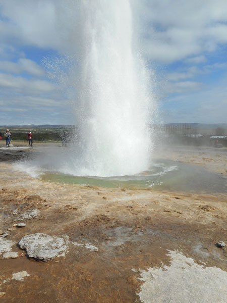
| "Geysir" doesn't erupt very often now (earthquakes in the last century are blamed). This is Strokkur ("the churn") which seemed to erupt about every 6 minutes. |
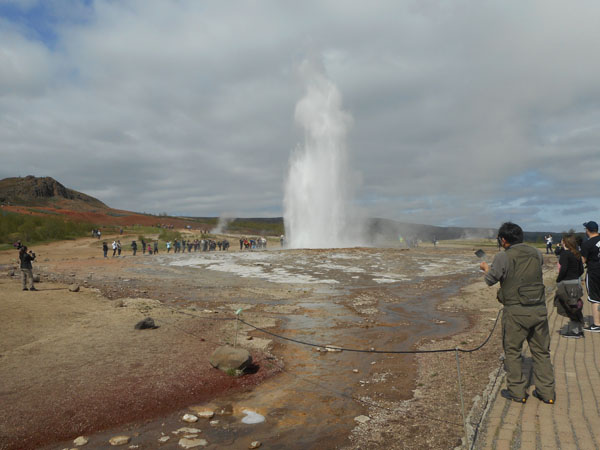 |
| It would go from flat |
 |
| drop the level |
 |
| bulge, and then erupt. We were pleased to be able to watch several cycles in a short time. |
 |
| Before wandering into the well-stocked shop looking for food. |
 |
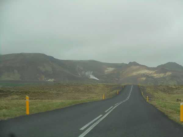
| Driving east once more toward the mountains |
 |
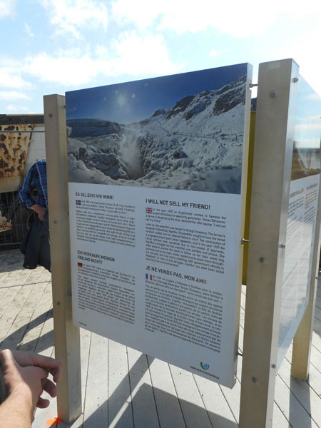
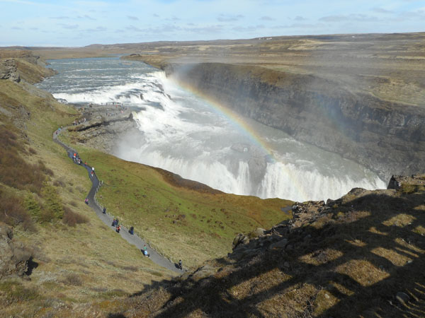
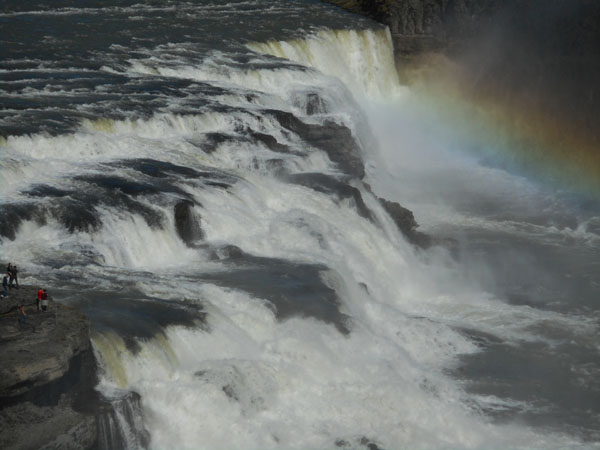
| We came to Gullfoss ("golden falls") which was saved by an outspoken young woman who protested plans to harness the falls for power generation. |
 |
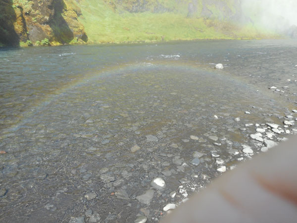
| They say that if the sun is out there is almost always a rainbow (remember that Iceland is far enough north that the sun is usually very low in the sky here even though it is light most of the night in the summer) |
 |
| |
 |
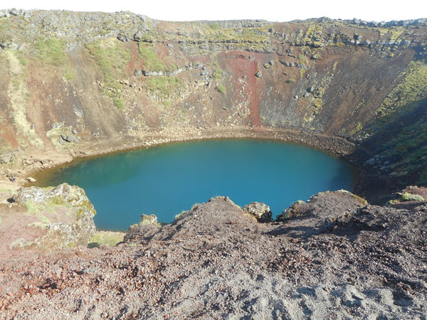
| On the way back to Selfoss, we came across a very unprepossessing hill by the side of the road with a parking lot. |
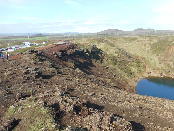 |
Clamboring up the 40-odd feet to the edge let us look down into Kerið, a small, but very pretty, crater. The lake is quite a bit below the surrounding ground level (including the roads), and reflects the area's water table. |
 |
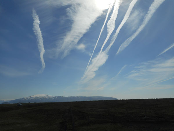
| By the time we neared the end of our day's Golden Circle circuit, the weather had turned. For the rest of the trip most of the clouds were contrails of jets to and from Europe. |
 |
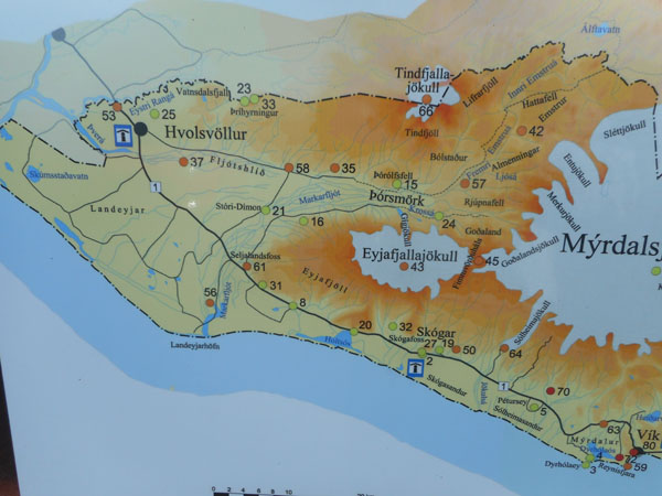
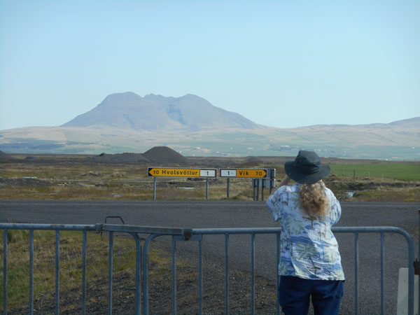
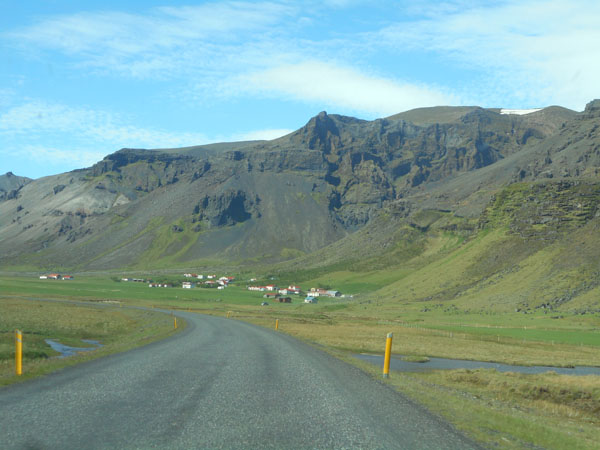
The next morning we left Selfoss (a bit off the map to the northwest) for the town of Vík (very lower right).
"vík" is Icelandic for "town", so Icelanders add "by the Myrdal glacier" if there is any confusion. |
 |
| They are well set up for tourists and other lost souls: when you pull off onto most side roads from Highway 1, there is frequently a sign... |
 |
Listing all the farms that the road accesses.
This was an uncommonly busy section. |
 |
| When you returned to the the main road (there is only the one road "#1" all the way around the island) they tell you which way to turn and how many kilometers to get to the next major town. |
 |
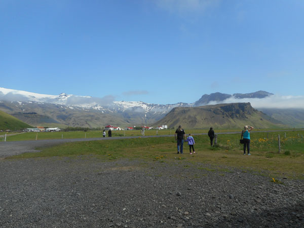
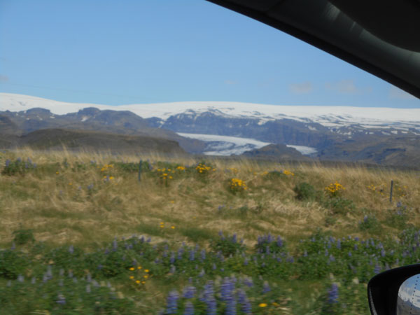
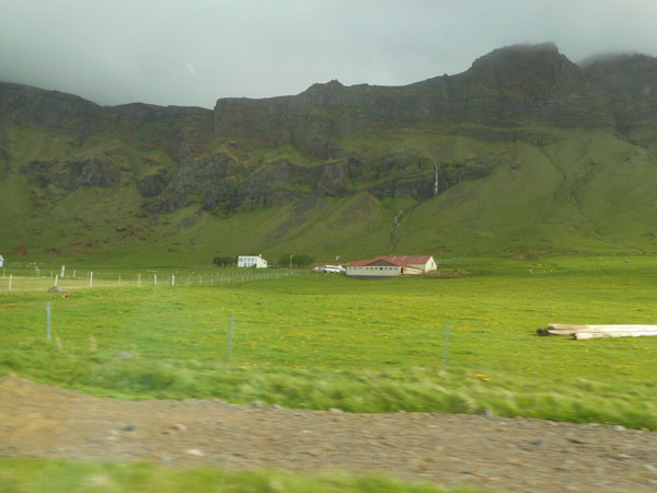
| We started seeing more mountains and snow. |
 |
| And melting snow running off mountains gives waterfalls |
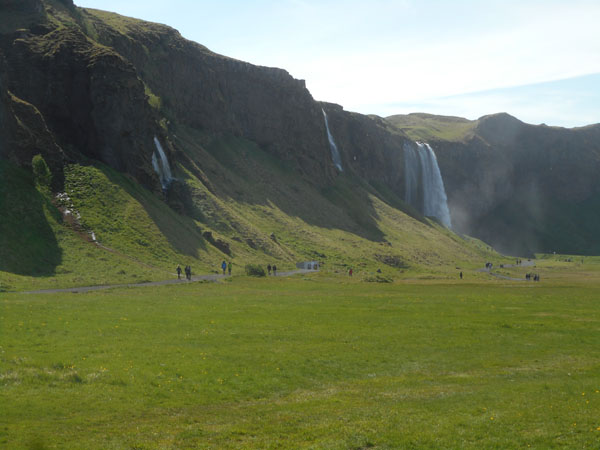 |
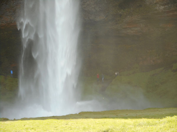
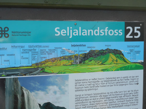
| Seljalandsfoss is a complex of four falls coming off a 200-foot-high cliff, one hidden deep in a cleft of the cliff face. |
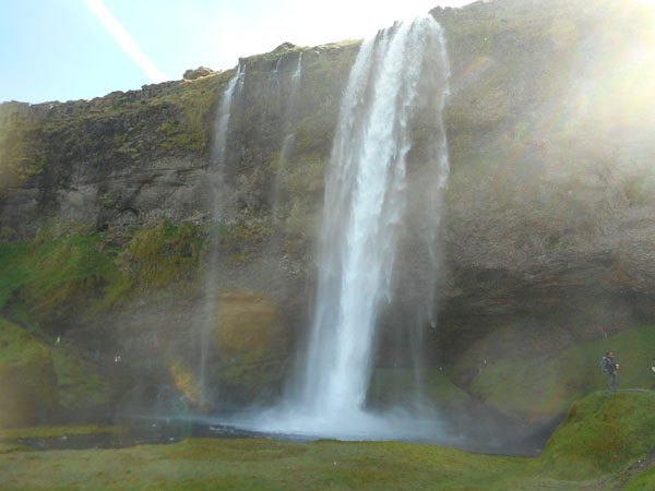 |
| This is a waterfall you can walk behind, if you feel in need of a cold shower. |
 |
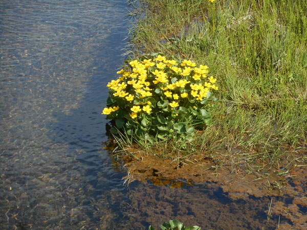
| There were buttercups along the streams |
 |
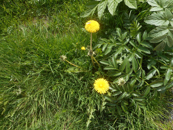
| ... and dandelions where it was drier |
 |
| Grand views |
 |
Lots of waterfalls ("foss" means falls) along this escarpment. This cliff used be at the edge of the sea, but the land has risen and the seas have fallen to leave it exposed. |
 |
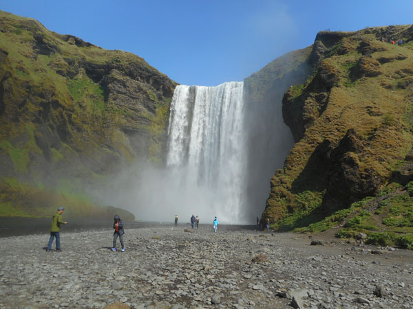
| 30 kilometers further west is the town of Skógar, adjacent to the foot of Skógafoss.
This 200 foot tall fall is fed by both the Eyjafjallajökull and Mýrdalsjökull glaciers. |
 |
| Another spot with a "reliable" rainbow. |
 |
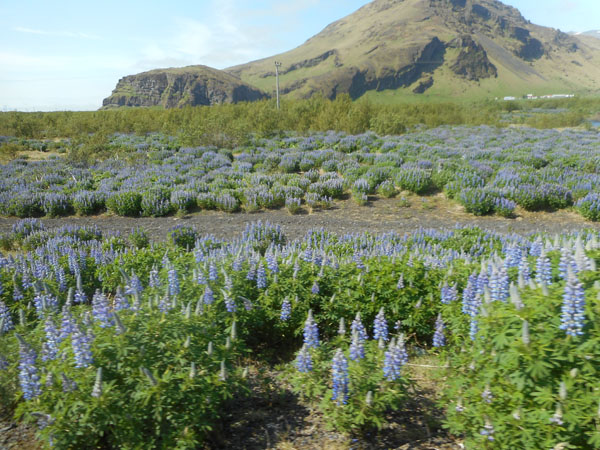
| Huge expanses of blooming lupine kept brightening our days. |
 |
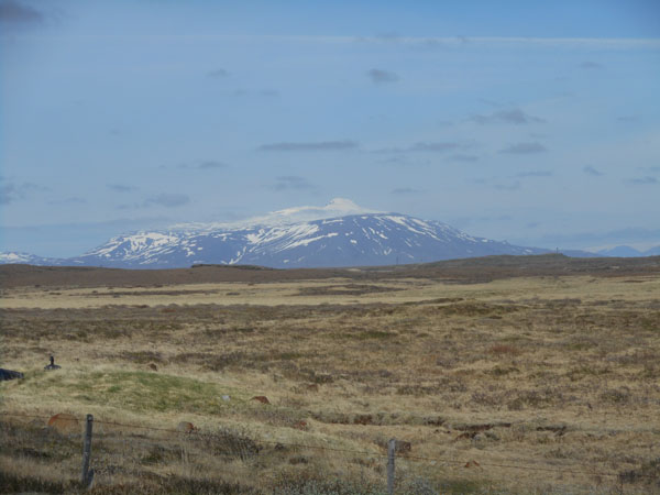
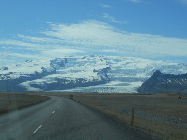
| The Mýrdalsjökull glacier, which completely covers the (active) Katla volcano. |
 |
| With the occasional vehicle left while obtaining parts. It seems a very trusting society: people left things waiting for them to get back to. There seemed to be no graffetti or similar property destruction. |
 |
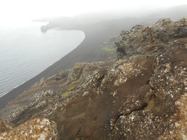
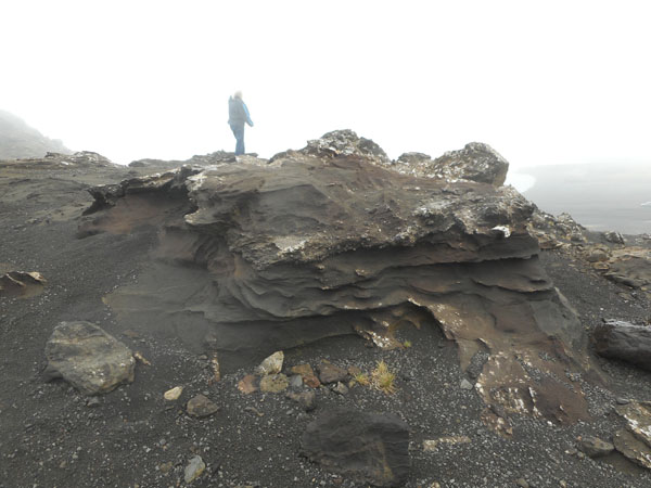
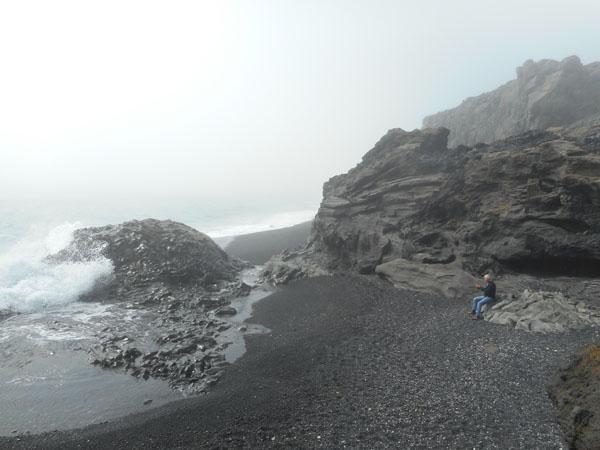
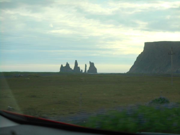
| When we got near to Vík the fog rolled in off the sea. Both sides of a scenic inlet mouth just west of Vík are known for their rock formations, so we decided to go into the fog to see what we could see. |
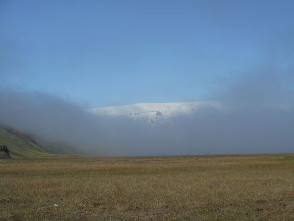 |
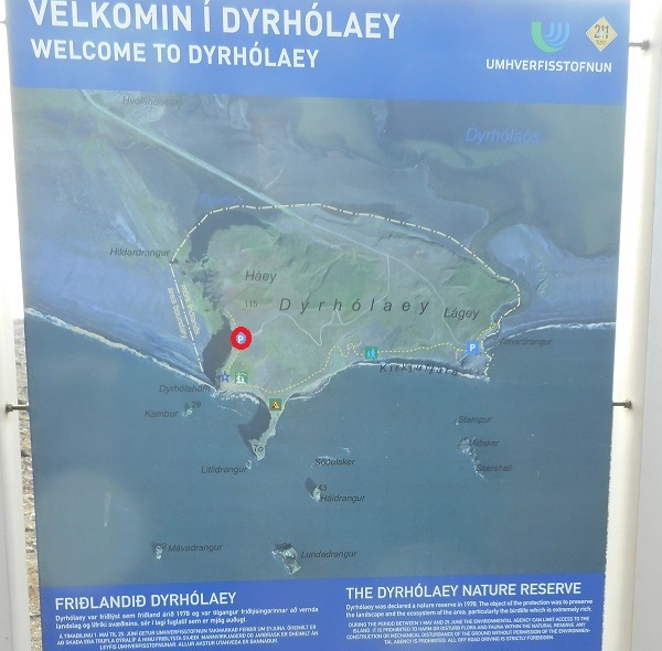
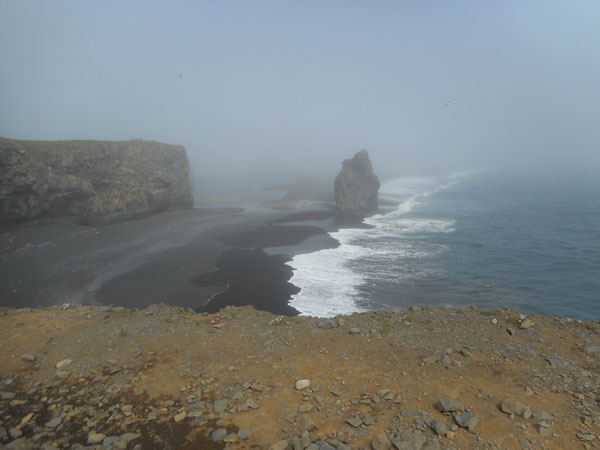
Here is an aerial view of the western point on a clear day.
We were at the red circle, all of the items "below" the coastline are offshore rock pillars. |
 |
| ... here's the fog. The surf can be seen, but the offshore towering rocks were completely invisible. |
 |
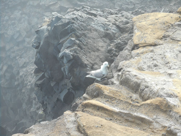
| An outraged gull was visible. |
 |
| But even foggy surf will capture an onlooker. |
 |
| ... and us. |
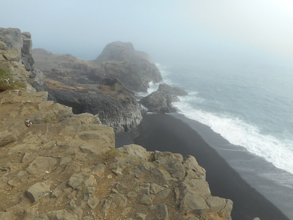 |
| While we were there the fog parted enough to see one of the sea stacks. That's Litlidrangur, even reachable by foot during low tide. |
 |
| We then drove back to Hwy 1, then a bit east, then out on a side road to the other side of the inlet. It was sunnier and slightly less fog-bound. |
 |
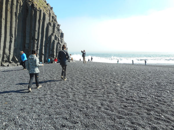
| Instead of up on the headland, the road brought us to a wide pebbled beach... |
 |
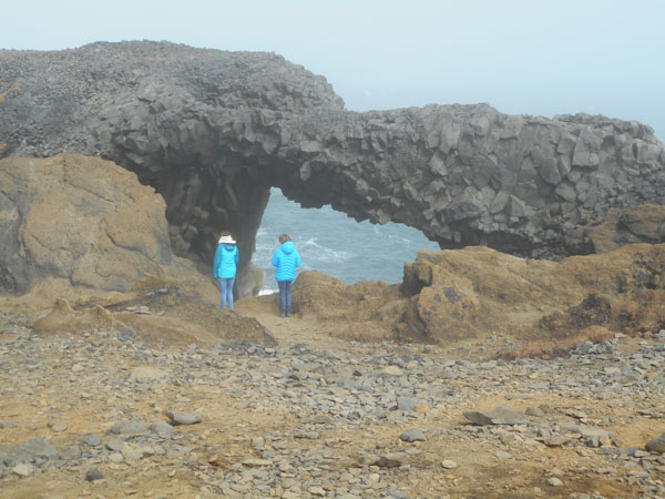
| With the headland towering above us. This point featured a 100 foot-tall shallow cave with lots of basalt columns. |
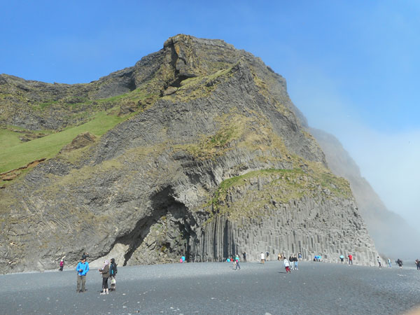 |
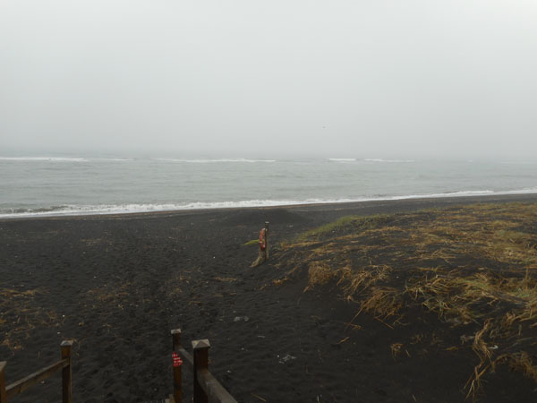
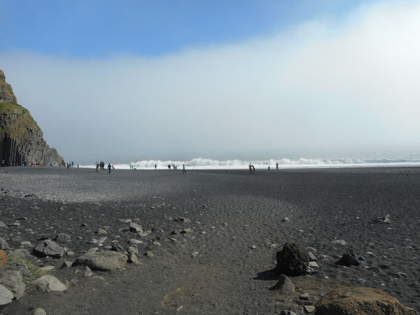
| and black sand (and gravel) beach |
 |
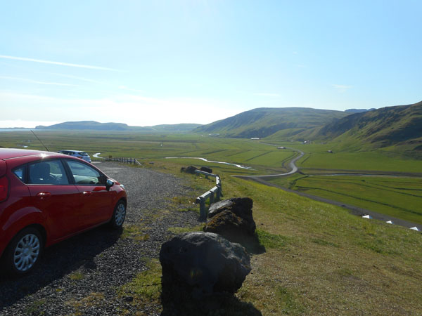
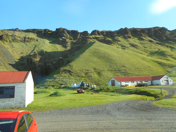
| Back on Hwy 1, we crossed the spine of the headland to actually reach Vík. An attempt to find ice cream failed, so we backtracked westward across the headland again, since that's where our next lodging was located. The Highway's viewpoint gave us a fine view. The second farm on the north (right) side of the road, Gilgur, is where we will stay the next two nights. |
 |
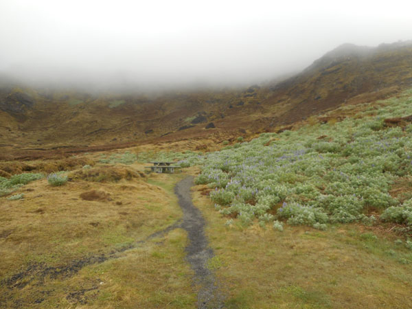
This was arranged through "Icelandic Farm Holidays" (an AirB&B competitor).
The farm backed up against a sheep-littered (the white dots) hill. The shadowed area of the hill had flocks and nests of spiralling terns. Both birds and beasts kept us fascinated and amused for hours.
|
 |
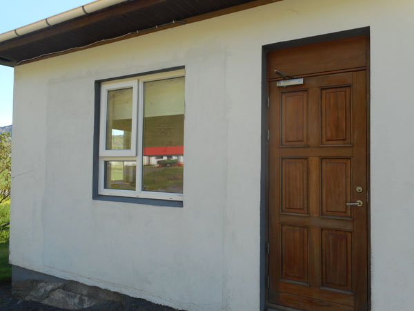
| Our own door to the outside |
 |
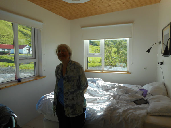
Out one window we watched terns swooping, out the other lambs cavorting.
Despite the "early local sunset" caused by the cliff's shadow, it was still possible to read in bed, with the curtains dropped, without a light, until after 11 pm. |
 |
| In the morning we set off to drive as far east as we could before having to come back for the night. |
 |
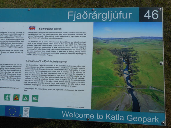
First stop up a (narrow, unpaved and rough) side road was the valley of (read it off the sign)
Dick developed the habit of just saying enough partial syllables to perhaps convey his meaning to Karen. This spot probably would've come out as "Fjaog", but more likely as "Where??".. |
 |
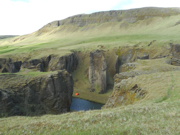
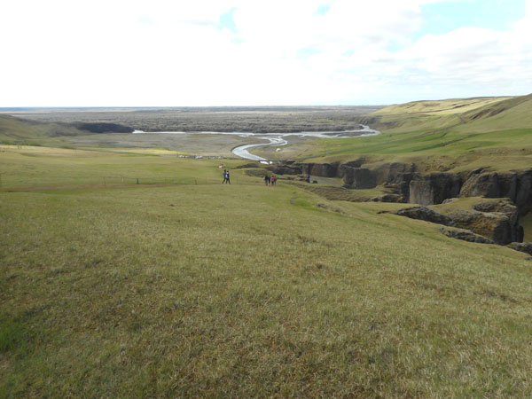
| A well-marked path followed the top of the right cliff, usually far enough from the edge to keep Karen comfortable. |
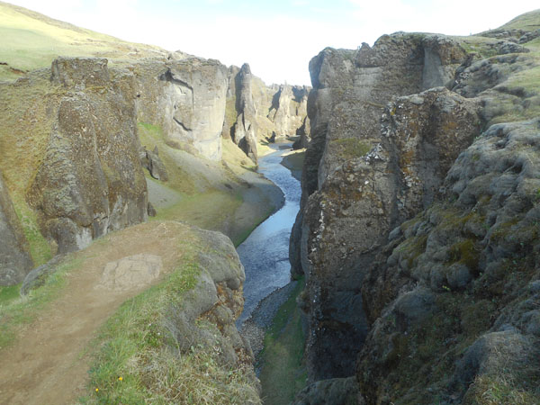 |
| There were signs of tents and beached kayaks along the river itself. |
 |
| The water spills out into the usual braided stream. |
 |
| We noticed a rental vehicle that would have worked if we had wanted to try our usual camping routine (we'd prefer more windows). |
 |
and another we weren't quite sure about. |
 |
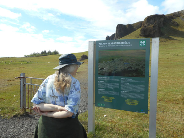
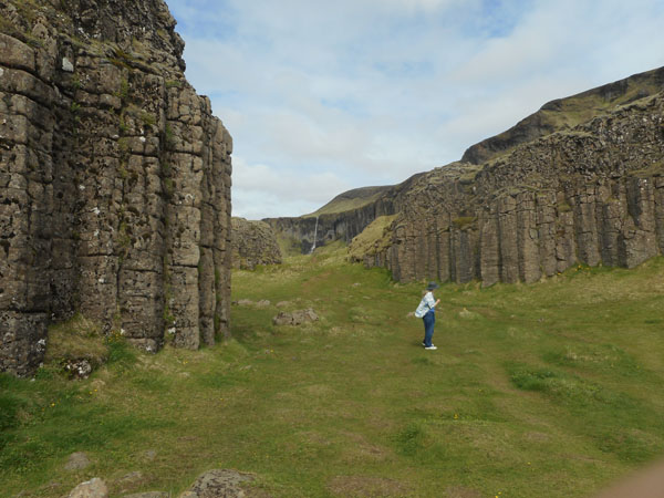
| Our next stop's tourist-worthy sight translates as "church floor" |
 |
| It's the tops of basalt columns... |
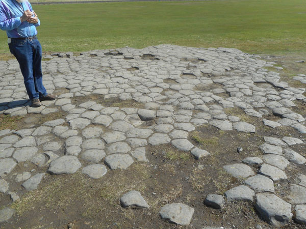 |
... in the middle of a sheep pasture. road Path hazards. |
 |
| A little further along brings more waterfalls, this one on private property. |
 |
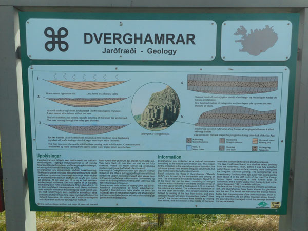
And a schooch beyond that: a pullout with the two typical sign-styles concerning a sight.
First we have the geologic description (of a couple of vertical basalt column groupings)... |
 |
| ... and then we have the "Cultural" description of how the site fits into the Icelandic Saga cycles, in this case involving tales of dwarves. |
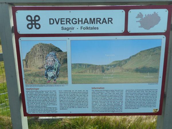 |
| We saw the columns, not the dwarves. Not even in the nooks and crannies. |
 |
| The pre-glacial shoreline was at the top of the cliffs so we are driving on ancient tideflats. Around the bend... |
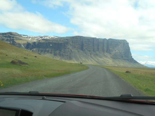 |
| We encounter a broad glacier. In the photo it doesn't look impressive, but there's a sheet of ice starting at the tip of that left-edge headland, and spanning the rest of the width of the photo. The ice is under a collected scattering of volcanic ash and pumice which makes the entire front slope look black. |
 |
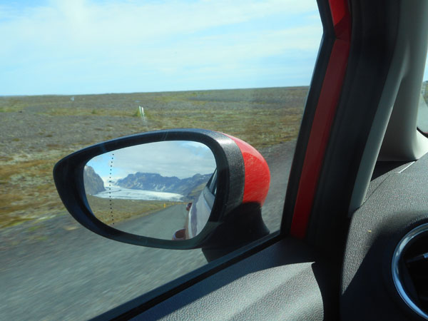
| Driving a good deal further brought more "typical" glacier-like sights into view. Skaftafellsjökull (left) and Svínafellsjökull. |
 |
The highway is that red hairpin entering from the bottom. At the bend (and left side-road) is another waterfall (Svartifoss).
The previous photo is of the two glaciers just to the right of the hairpin. |
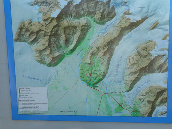 |
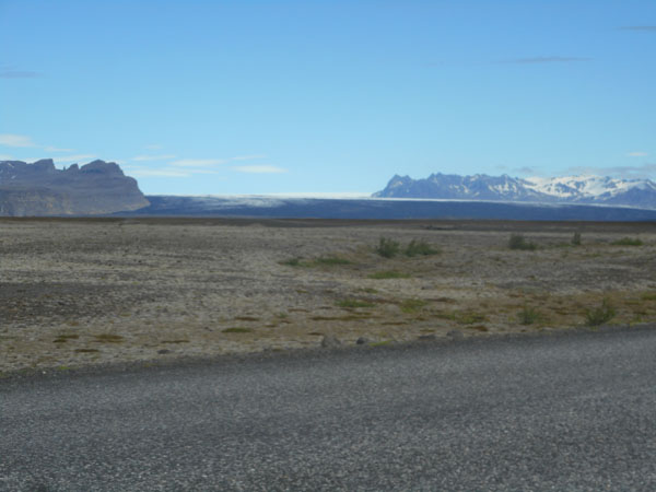
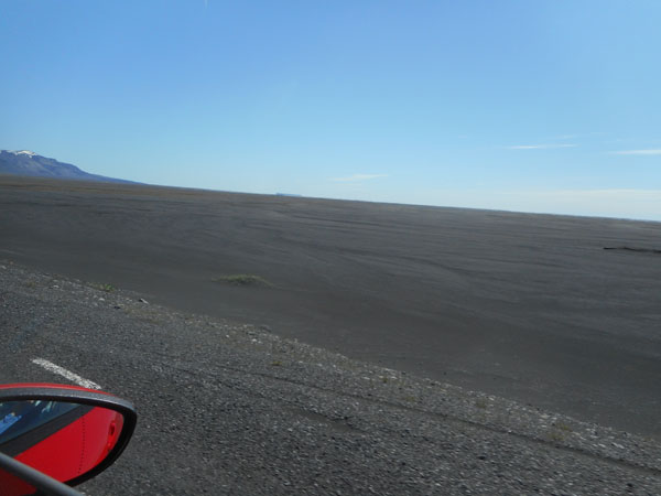
Looking away from the glaciers towards the sea (30 km away) is Skeiðarársandur, the black sand "desert". This is the result of floods from erupting volcanos under the glaciers. This used to be the first sign of an eruption. Now they have better monitoring systems (we hope).
All of the guidebooks recommend getting the extra "sand and ash" insurance if you plan to go here. If a wind kicks up it sandblasts all of the exposed plastic on the car (light covers, etc) and it has to be replaced. The insurance costs more than the rental. |
 |
| This 70 km stretch was the last part of the ring road to be completed and paved. Even now it has relatively inexpensive "semi-disposable" one-lane bridges (with wide spots for passing). |
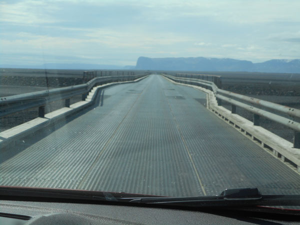 |
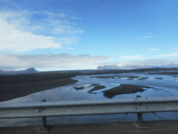
| ... over the many braided streams. If an eruption flood happens, they simply replace the segments of the bridge that washed away. At least three of the highway bridges are built with multiple standarized 44-meter-long spans on (hopefully) solid footings. One "spares kit" serves them all. |
 |
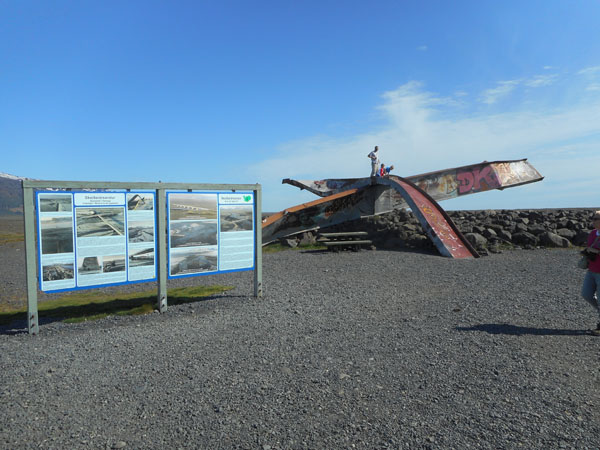
| This was an attempt at a "permanent" bridge, in place before one of the most recent floods. When a fleet of thousand-ton icebergs hits the bridge, even the concrete footings get torn away.
The wreckage made a wonderful slide for the children in the photo. |
 |
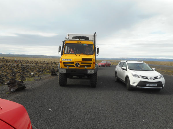
The few folks who live in this quadrant are tucked into sheltered spots. If they lose the bridge they have to drive around the island the other way. If they lose 2 bridges (a central volcano has been known to flood both north and south) they are cut off till there is a new bridge or the have a way to ford the river. Note big tires and engine snorkel. We see many such vehicles in parking lots around here.
(Car geek note: that's really a tourist's Unimog with a camper. Real Icelandic off-road trucks have much fatter tires.) |
 |
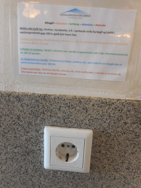
Dick (who'd obviously been driving just a bit too long without coffee) found the signage in one of our stops amusing: this outlet is for shavers only, 200 krona fine for using it to charge your cell phone (about $1.75).
Adding to the amusement was the wording that the confiscated devices would be charged in the information desk for that 200 ISK. Much friendlier than simple impoundment. |
 |
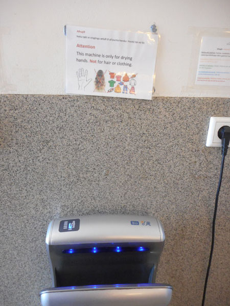
| You can just hear the cultural frustration |
 |
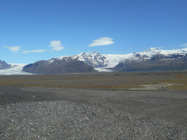
Another of those "the photo just doesn't do it justice" spots. We were seeing 180 degrees of glacial ice sheet only a few miles from where we were standing near sea level.
Point your arms straight out to your sides. Now pan your head from one hand to the other. That much. All glacier. And ready to melt at the burp of a volcano (or further elevation of CO2). |
 |
| The ice sheet just kept going (as did we). |
 |
| ... passing over rivers with iceburgs floating in them |
 |
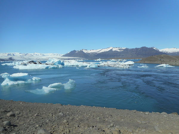
| Our goal for the day: We reached Jökulsárlón, the "Glacial Lagoon". |
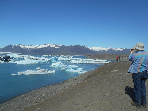 |
It's a small lake, about the size of Seattle's Greenlake. Across the water the (inhale) Breiðamerkurjökull glacier is calving into it.
When we looked at the stream leading out of it towards the sea (about 1/4 mile away), we saw a "tidal rip" flowing into the lake. It's tidal! We were lucky enough to have arrived just as the incoming tide was beginning to float the stranded-by-low-tide bergs off the bottom. They'd been melting their bottoms during low tide, and now shifted and rolled to their new balance points. Many broke apart during their gyrations.
Most of the smaller bergs you're seeing are about the size of houses. |
 |
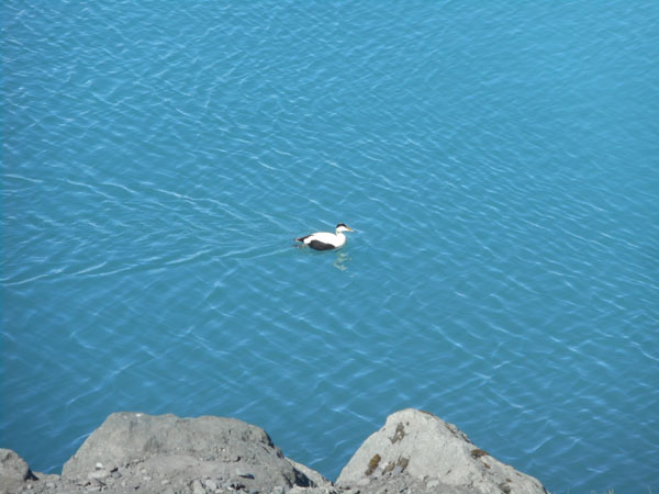
| We saw several eider ducks cruising the shoreline... |
 |
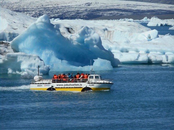
| ... as well as people-carrying ducks puttering along further offshore. |
 |
| Then we turned for home (Gilgur's), 160 km away. |
 |
| Waving goodbye to the glaciers |
 |
| and the small farmsteads |
 |
| We stopped at an unusual sight. |
 |
| This was a farm and the owner encouraged visitors to add a rock to the cairns for good luck. The farm is no more but the highway department brings in rocks so passing travelers can still add rocks to the cairns (this is an exception: in other parts of the island they ask you to not add or subtract rocks from cairns because they are historical artifacts) |
 |
| We need all the luck we can get |
 |
| As we pass Vík we notice that the fog has gone and we can see the sea stacks. |
 |
| The next-to-last morning the clouds are low... but they rise enough to clear the hills for the drive back from Vík, through Selfoss, left at Hveragerði (missing Reykjavík ... again), through þorlákshöfn, and once more along the southern edge of the Reykjanes peninsula. |
 |
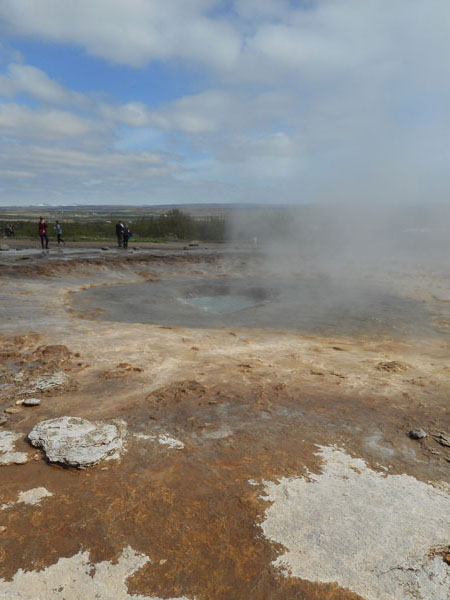
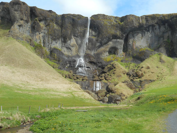
| And the higher clouds induced us to return to the Seltún geothermal area (site of the wet-and-cloudy wedding photo shoot). This time the higher clouds let us see that there was another steamier spot above and to the left of Seltún itself. It was on private land behind signs, so we couldn't access it. |
 |
| So what? At Seltún we could see more... we could tell the geothermal steam apart from the (absent) low clouds. |
 |
| We could even see the lake in the distance (and that there were more women in line for the WC). |
 |
| From Seltún we didn't retrace our path northward ... instead we dropped back south and continued westward along the southern edge. We passed a lovely blue lake (but not the "blue lagoon"... yet) |
 |
| We drove west along the peninsula's south shore: miles and miles of moss trying to grow on crumbled lava. |
 |
| At noon we reached the harbor of the fishing town Grindavík |
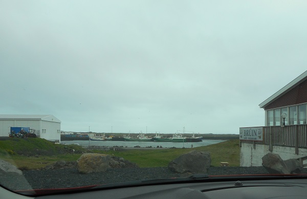 |
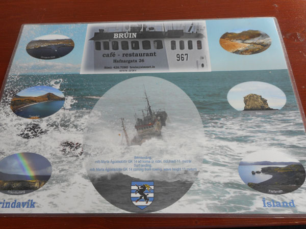
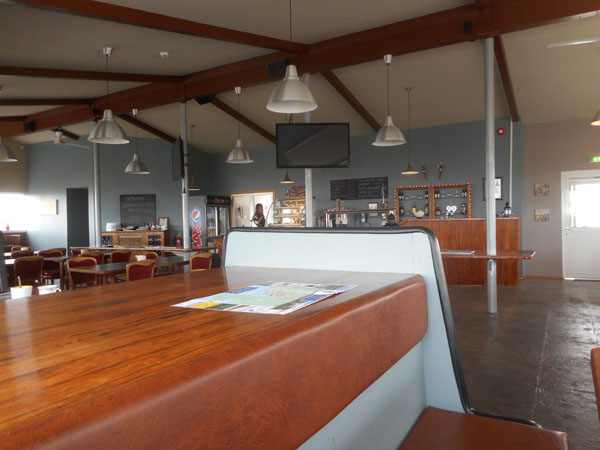
| Drawn by sandwich boards placed up on the highway, we spiraled down to the harbor to discover Brúin |
 |
| It seemed a bit empty when we entered, but it was a Sunday morning, and we were pretty much a "stroke of noon" arrival. |
 |
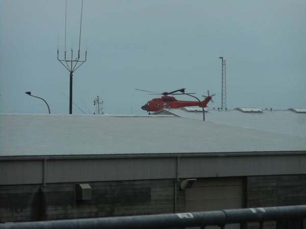
| But they had big windows overlooking the harbor and the (shut for Sunday) marine area ... when Dick noticed ... |
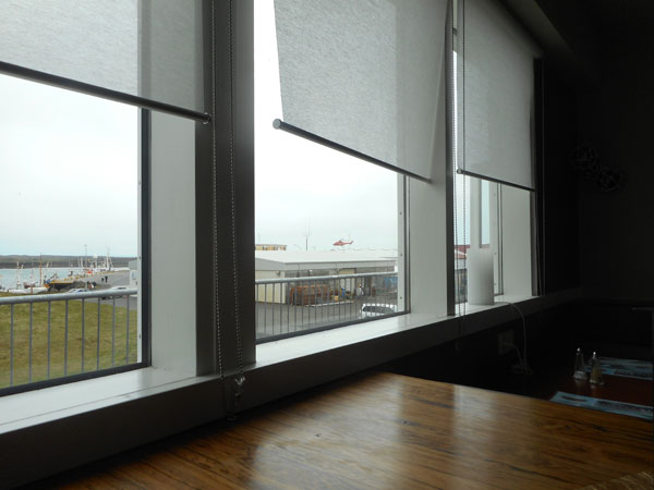 |
| ... a helicopter apparently doing "touch-and-goes" and hovering practice beyond the buildings. Some things can keep him amused for quite a while. |
 |
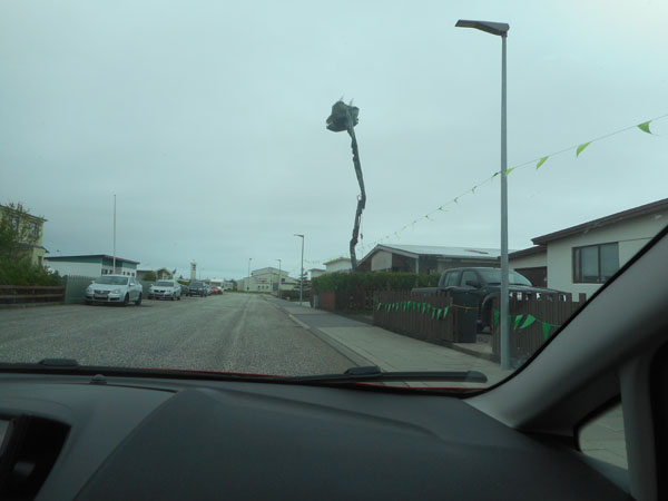
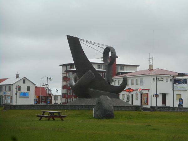
| After lunch, we sought out the town's Ice Cream shop ... they didn't have coffee flavor, so we started to drive away. Then Dick spotted a green monster peering over the rooftops as we are leaving town. |
 |
| So we had to go investigate (yet again ignoring the mild squeals of protest by the GPS). The dragon proved to be a cherry-picker in disguise. |
 |
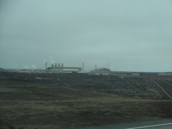
| Heading straight north from Grindavík, we passed the geothermal plant which heats much of the penninsula. The famous "Blue Lagoon" is its waste mineral water pool. |
 |
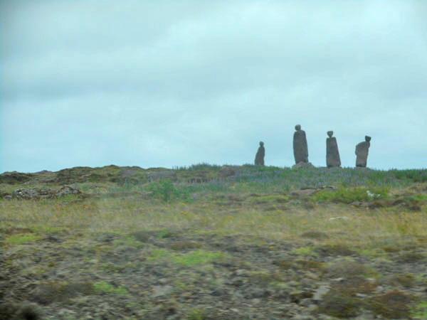
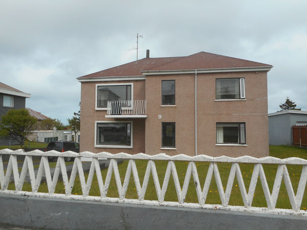
| Along a few of the highways on the Reykjanes peninsula there were these stone "watchers". This group loomed over us on the hill outside of the town of Keflavík, near the airport. |
 |
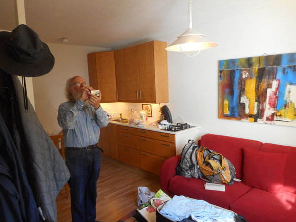
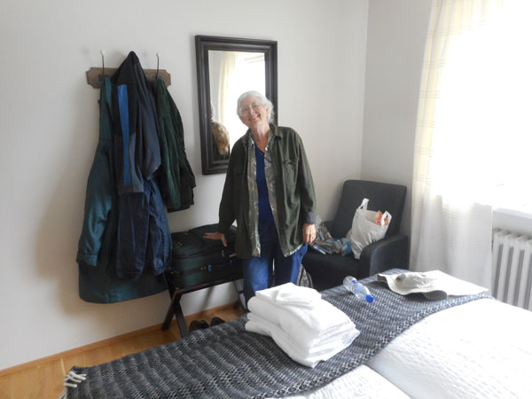
| Our final night would be a comfortable room at "Cloud 9" Air B&B in Keflavík, hosted by Thora. |
 |
| We explored the town, checking out the waterfront while looking for a bakery for "airplane food" and (of course) ice cream. |
 |
| And thence to tonight's "home" and packing process. |
 |
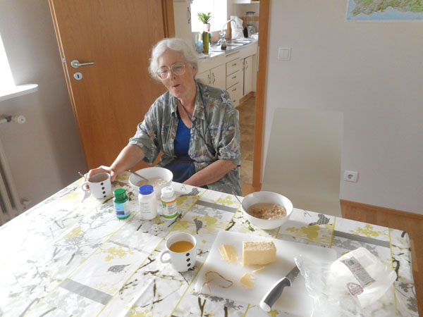
| This was the only spot that didn't have a microwave for our morning porridge (oatmeal), so for the first time in the entire 5-week trip, we used the stove. |
 |
| Unlike the gloomy Sunday, and certainly unlike our arrival day, our departure day was bright, sunny and calm. |
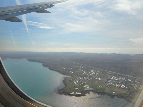 |
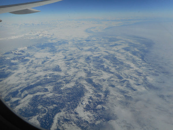
| We were able to see ice off Greenland's east coast... |
 |
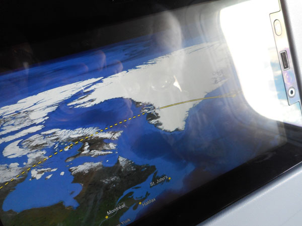
| ...and (our favorite in-flight movie: "Where We're At") ... |
 |
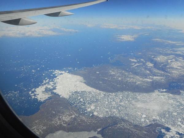
| ... the ice on Greenland's west coast. Karen has been working on glass designs that include Greenland, and she recognized the specific fjords we were seeing. |
 |
| The shadow of our contrail on the artic bogs in northern Canada |
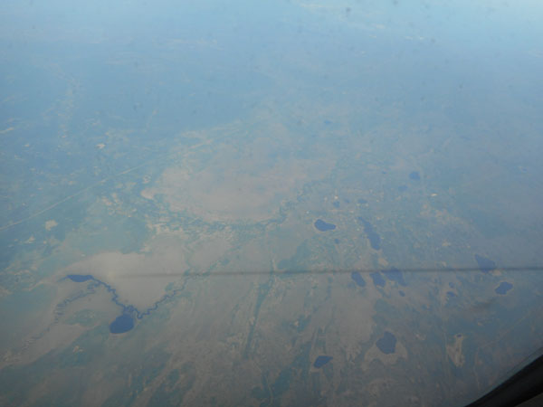 |
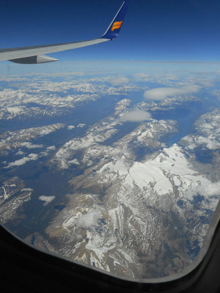
| The familiar BC Rockies |
 |
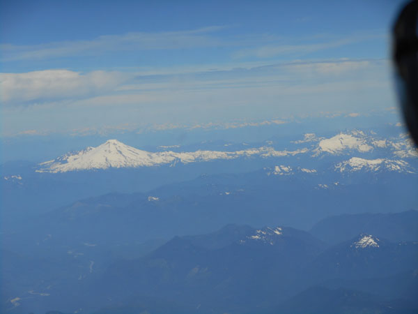
| Mt Baker |
 |
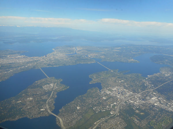
| And even Mt. Rainier |
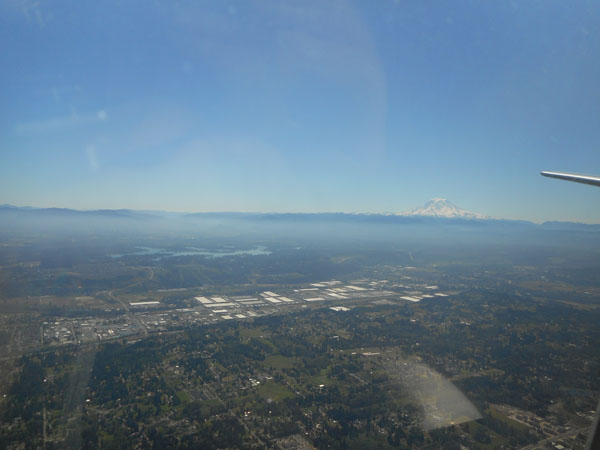 |
And home.
Our mid-morning departure from Iceland meant that we had an 8 hour all-daylight flight, landing in Seattle only one "clock hour" after we departed. "Body time" was 7 hours later. |
 |