Travels with Dick and Karen
Britain Part 1
Southwest & Cornwall
|
Why the UK? We have always wanted to go and see the landscape that provided the background for so many of our favorite books. It seemed like it would be an easy trip and the right time to take it. We even had people to visit: Karen's niece married last year and is living in Abingdon. Our Seattle next-door-neighbors were in Edinburgh on sabbatical.
In retrospect, because of the stress of driving a large vehicle on too-small roads, it was one of the hardest trips we've yet taken. |
|
 |
|
Our flight left Seattle at 7pm in an overcast early June.
Although we couldn't see the ground, early in the flight we got to see a glory around the plane and the shadow of its contrail on the clouds below us. |
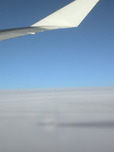 |
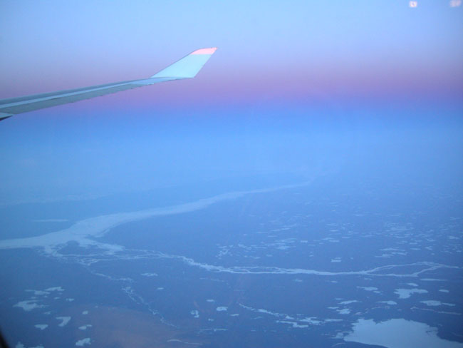
This was an overnight flight crossing over the arctic circle.
The sun never really set at our altitude.
As usual, we were the only passengers in the entire cabin who kept their window shade up throughout the flight.
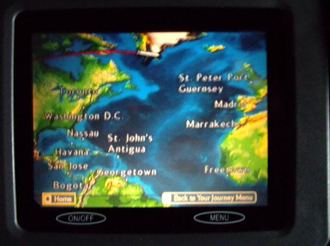
This is northern Canada, located with Flightaware.com and Google Maps as Keewatin, Nunavat (64.327N 101.145W) whilst writing this commentary. |
 |
| |
|
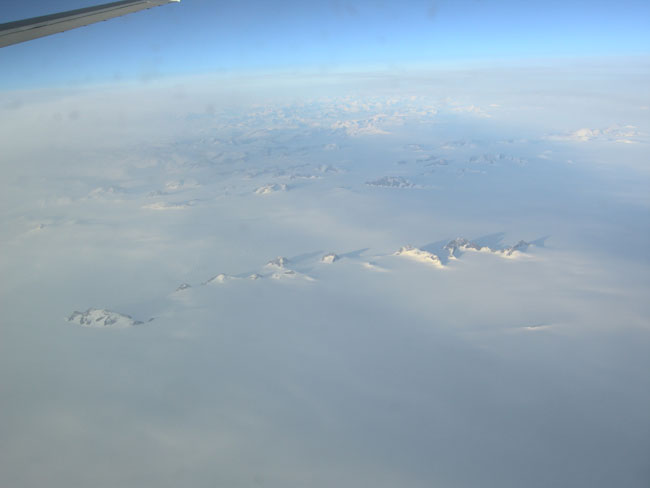
| Peaks of mountains just peek above the Greenland ice in the early morning. |
 |
| We could follow our flight on the little seat screens (if we weren't watching a movie). This was at about 1 AM "body time"... we're not great sleepers in airplanes. |
 |
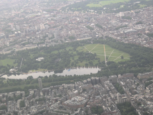
| Although most of Ireland and Britain were shrouded in clouds, they cleared for our descent over London and we got a glimpse of Hyde Park. |
 |
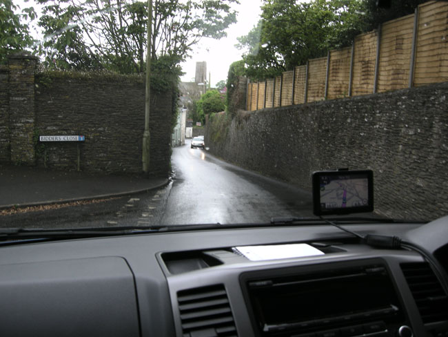
Mark from Kamper Hire UK picked us up at the airport and drove us down to his office in Droxford (between Southampton and Winchester).
Then Dick used the GPS (over here called a "SatNav") to drive to the nearby campground at Morn Hill in Winchester. It led us down interesting paved cow paths but we finally got there. Given that introduction, we changed the SatNav's settings to "Fastest", not "Shortest", and things were somewhat (not always) more reasonable after that. |
 |
One of the first puzzles we have to solve when camping in other countries is learning the names of the stores that sell things we're going to need.
Groceries, for instance.
Inquiring at the campground (pardon: Caravan Park) led us to Tesco for our first food shopping experience. We jet-laggedly staggered through the store picking up milk, cheese, sliced ham and oatmeal (pardon: porridge) and the things to cook them with: a microwave oven and a large Pyrex bowl. When we returned to the parking lot we were greeted by rain, hail and lightning. We let the storm pass before driving back to the caravan park. |
 |
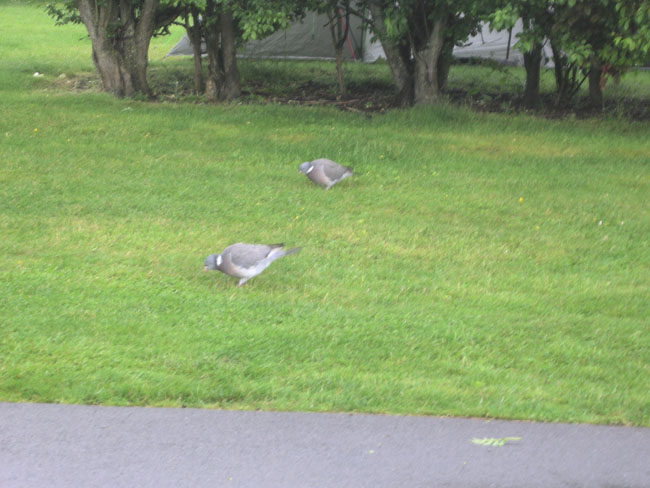
The next morning we were woken early by the large ring-necked pigeons cooing.
(these guys are huge... easily twice the size of an adult Seattle pigeon) |
 |
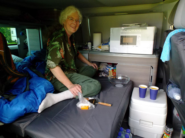
Setting up for breakfast -- preparing to unbox the microwave for its first breakfast. The van came with a two-burner gas stove hidden under the microwave's box, but we're not fans of fire in or near our vehicle. There was also an in-van sink and water system that we didn't use because all of the campgrounds had dishwashing stations with HOT water. On the other hand, the battery powered refrigerator (in the counter behind Karen) got heavy use.
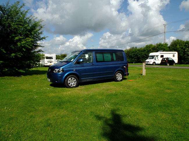
Part of the morning was spent moving all of the Kamper's kitchenware that we didn't plan on using into the microwave's box for under-bed storage during our month. This freed up storage space into which we emptied our luggage contents. All in all a nice van for us and we highly recommend Kamper Hire |
 |
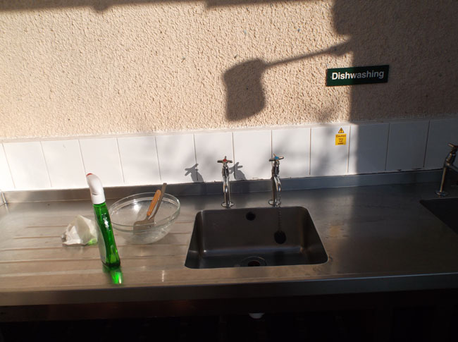
| All the campgrounds had multi-sink setups for dishwashing. Our shared "one bowl" (plus two cups and three spoons) meal system made for easy clean-up. The campgrounds also had (usually) well-thought-out places to empty the portable toilet. |
 |
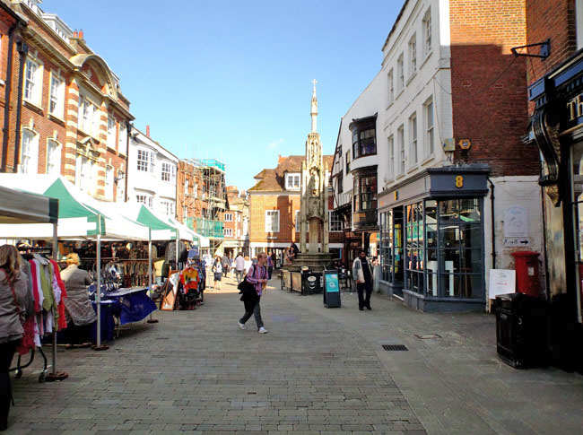
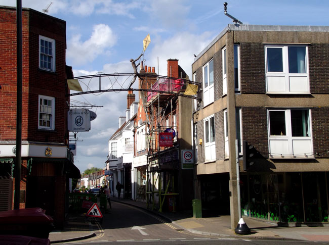
The next morning, jet lag plus getting everything unpacked and set up gave us a late start out of the campground. We headed off to tour Winchester for more supplies and lunch. We drove around the off-center of town twice before figuring out how to get into a parking lot that could handle the VW's height. These tents along Winchester's pedestrian-only High Street made Karen think of the art shows she was missing. |
 |
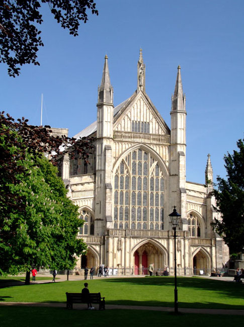
Shopping done, we walked around the outside of Winchester Cathedral.
Part of the shopping mission was to buy a local SIM card for our phone for the month. Mark of Kamperhire had researched the topic and recommended the "3" brand. We did ask in at the competition (ee, T-mobile, Orange, Vodaphone, O2, Virgin) and 3 met our needs far better than the rest. 20 pounds for a month with 300 minutes of talk-time, unlimited texting and unlimited 4G data. Coverage was quite good in almost all places. Unlike South Africa, the "month" was 30 days from purchase date, not terminated by the end of the calendar month. |
 |
| England is quite a bit north of Seattle.. so the sun set very late (it ranged from 9:15pm to 10pm during our trip). Here's the Sun showing low on a fun sculpture as we walked back the car to return to Morn Hill for the night. |
 |
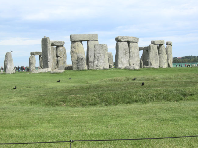
| The next morning we drove off (uncharacteristically early) for our first "Must See": Stonehenge. |
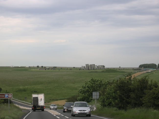 |
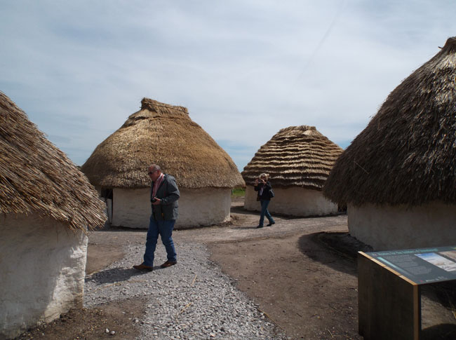
| They have recently moved the highway away from barely skirting the monument and opened a new visitor center. |
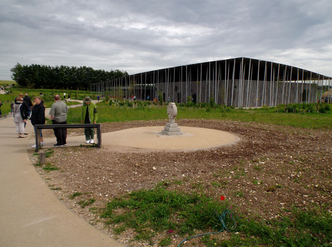 |
The visitor center includes a good exhibition hall and museum showing the history of the area, artifacts found at the site, and this small recreated village showing early types of housing. There was also the expected souvenir shop. |
 |
| You can walk, or take a little tram out to a paved walkway bordering the low one-rope fence surrounding the heart of the site. |
 |
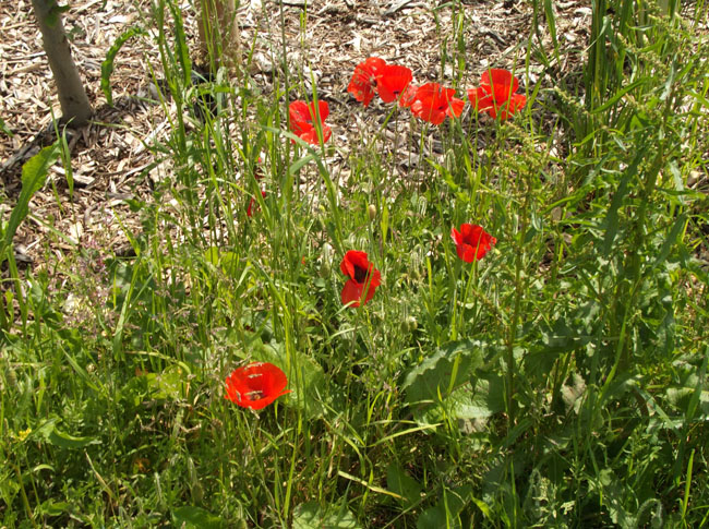
| Red poppies were all over the disturbed earth near the visitor center. |
 |
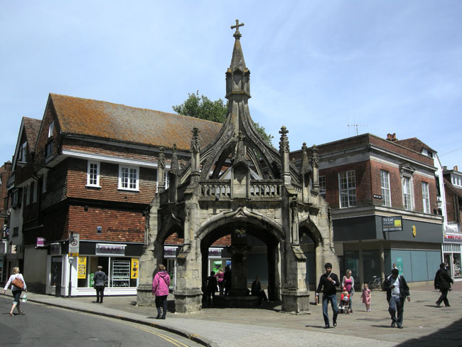
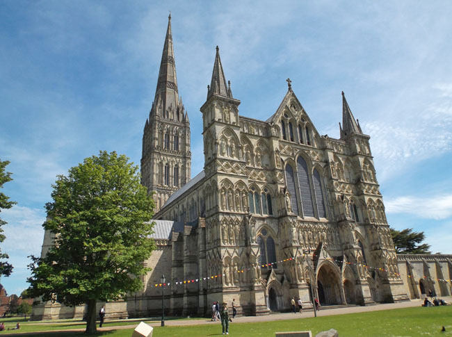
| Next stop: the nearby city of Salisbury. |
 |
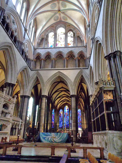
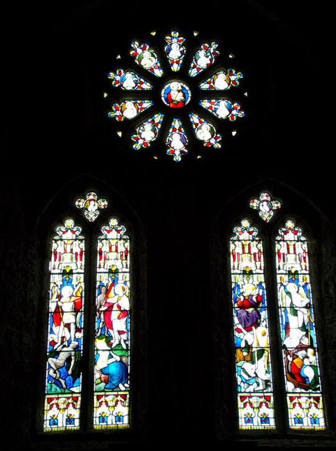
Where we toured the Salisbury Cathedral.
Its 400 foot spire is the tallest in England. |
 |
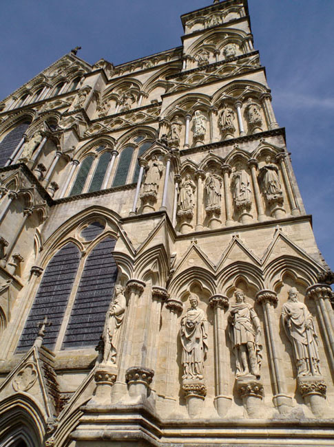
| Many cathedrals lost their statues in the reformation. Only 7 of these predate 1500, most of the rest were carved in the mid 1800's. A few are less than 20 years old. |
 |
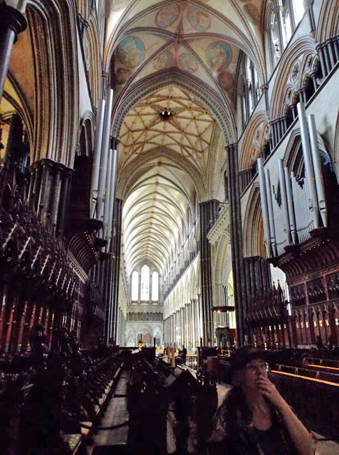
The sheer height of the vaulted ceilings is always awe-inspiring.
The use of dark columns and lighter high walls adds to the feeling of lightness above. |
 |
| The bishop was the architect. |
 |
| |
 |
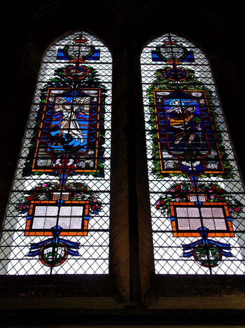
| Many cathedrals also lost their stained glass during the turmoil of the English Civil War in the mid 1600's. Changing "taste" on almost a century-by-century basis caused many of Salisbury's surviving windows to be replaced with plain glass. Most of the current windows in Salisbury are relatively "new" i.e. since 1800, but there are still 17 windows that date back to the Medieval period. |
 |
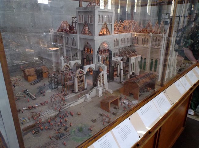
| They had a nice model of how it was constructed in the mid-1200's. The spire was added in 1320. |
 |
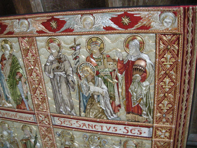
| Embroidered altar cloths. |
 |
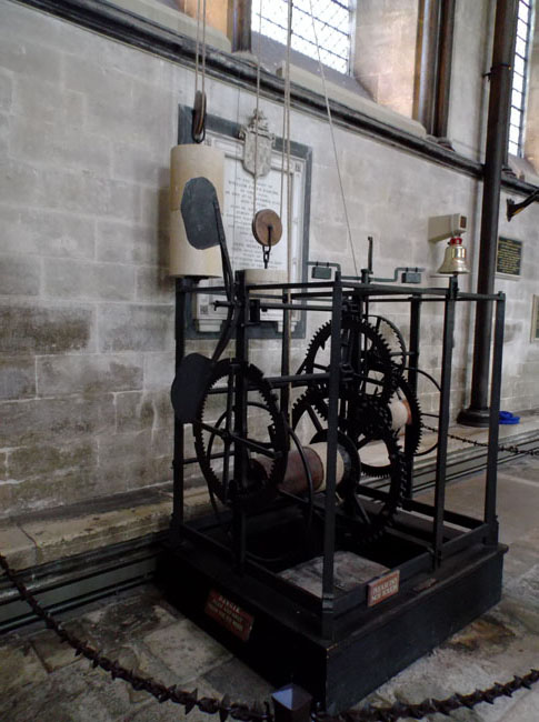
| And the world's oldest working clock which had been preserved and repaired since 1386. It has never had a "face", its job was to ring an hourly bell. |
 |
| |
 |
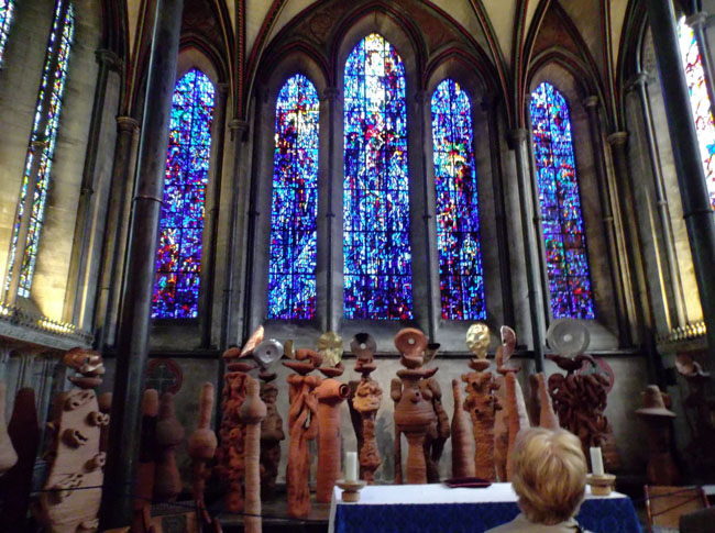
| The cathedral has temporary installations of new religious art. This is Nicholas Pope's dramatic The Apostles Speaking in Tongues Lit By Their Own Lamps as 33 terracotta figures - the 12 characters of the apostles and 21 multitude. |
 |
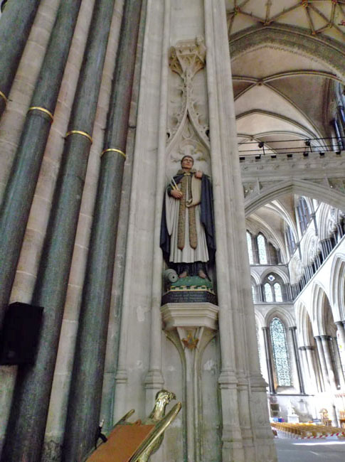
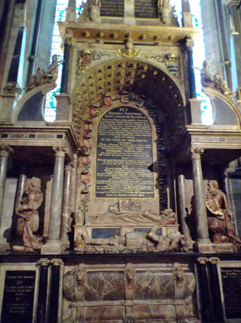
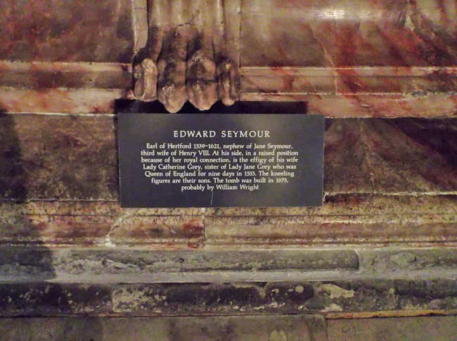
| In the back we found one of Dick's ancestors (Dick had seen it on a previous visit so it wasn't a surprise). |
 |
| |
 |
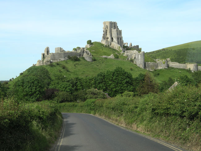
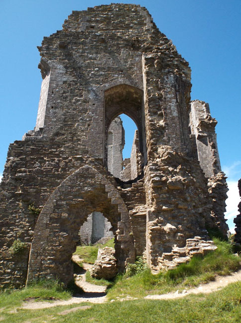
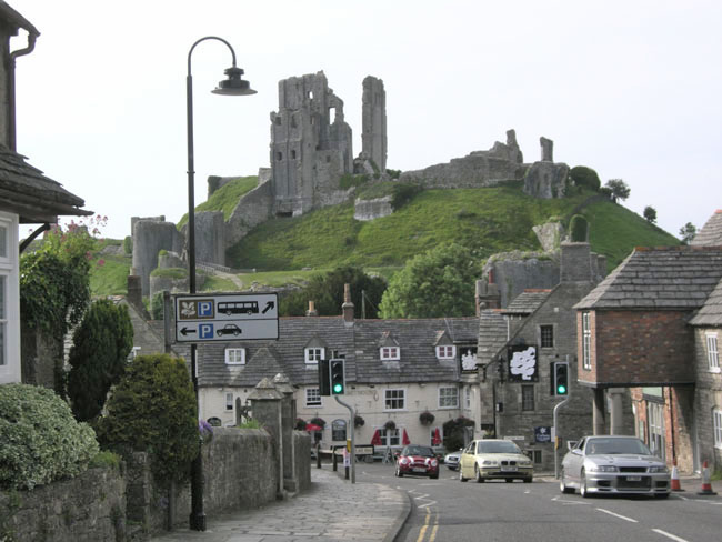
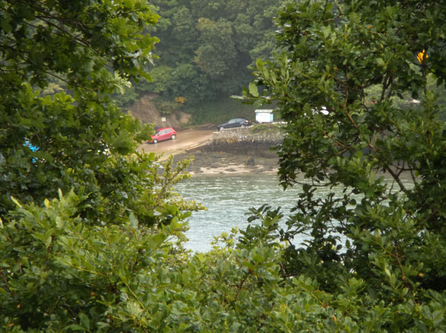
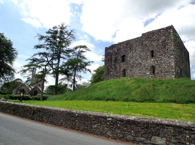
From Salisbury we drove southwest to reach Corfe Castle.
Another "learning the SatNav" incident had us driving about a mile up this fairly narrow (no room for a center stripe) road seeking our campground. Failing to find it, we drove back down (towards town and castle) until we had cell coverage and called them for more precise directions.
This view was worth the detour. |
 |
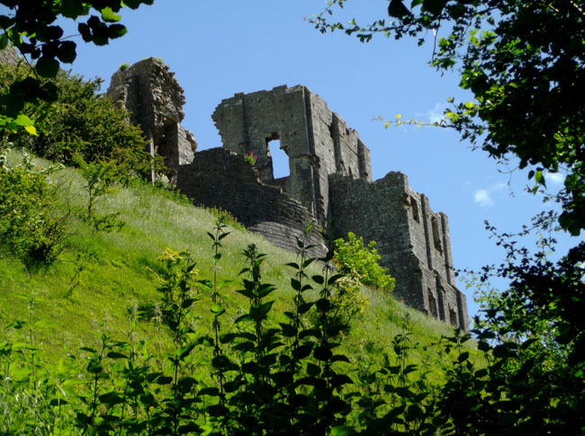
The next morning we started our exploration of the castle. It was built by William the Conqueror soon after 1066. In the early 1100's, Henry I added the stone keep. Numerous kings added to it at times of unrest. It withstood many seiges, and was one of the last royalist fortresses to fall during the Civil War in the mid 1600's. To prevent its re-use, many of the walls were broken or blown apart with gunpowder. The path from the parking lot to the gate took us on a half-mile walk around the base of its hill past cow pastures, along a river in a forest, through a couple of gates, up a hill and across a bridge spanning the dry moat ... |
 |
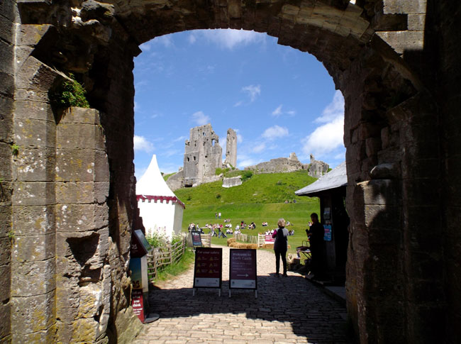
| to the outer gate (and ticket booth). |
 |
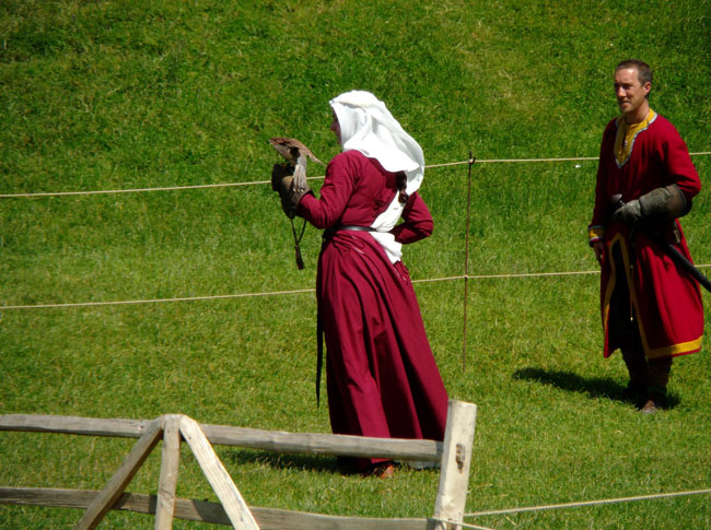
| On the broad lawn of the castle grounds there was an exhibition of medieval falconry. |
 |
| We clambered up and through the gates and walls of the castle. |
 |
| It had commanding views of the nearby town and surrounding countryside. |
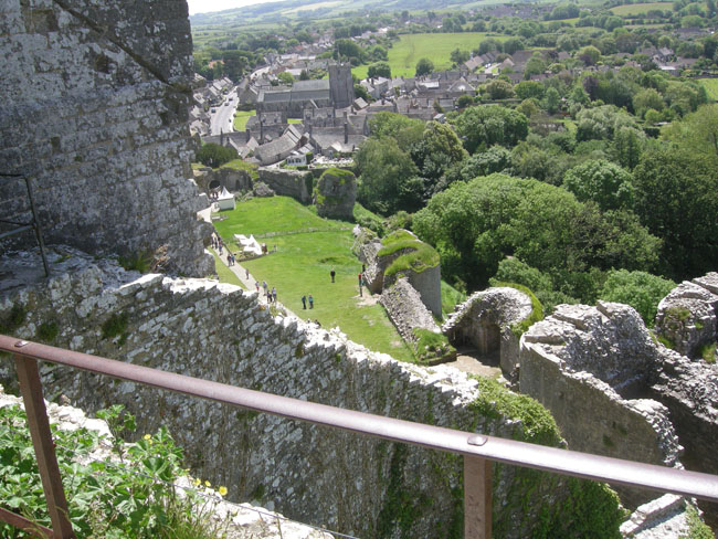 |
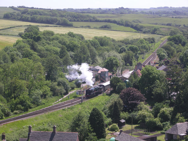
| The Swanage Steam Railway passes through Corfe. |
 |
| Now a few words about driving in the UK: |
 |
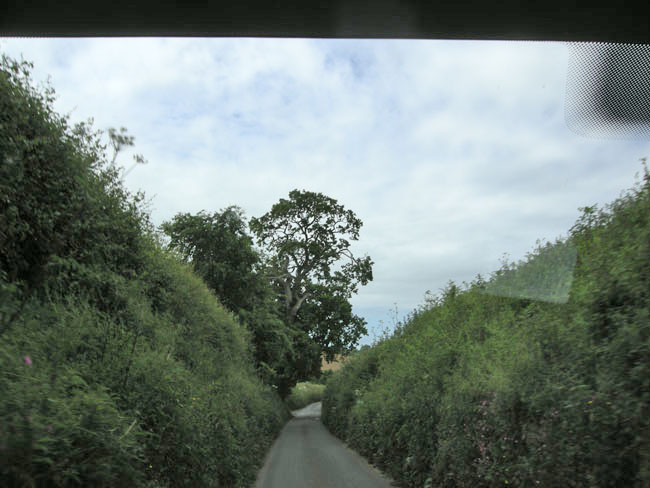
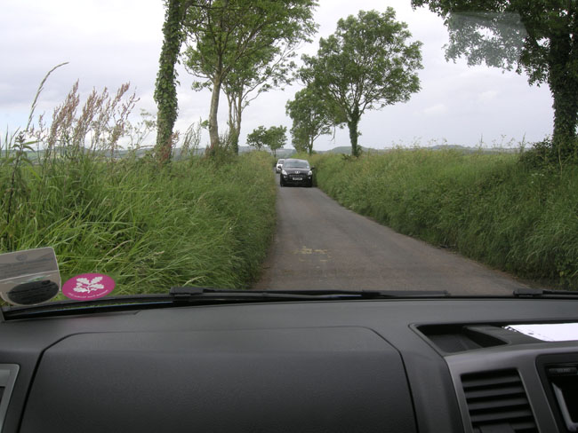
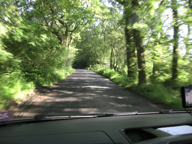
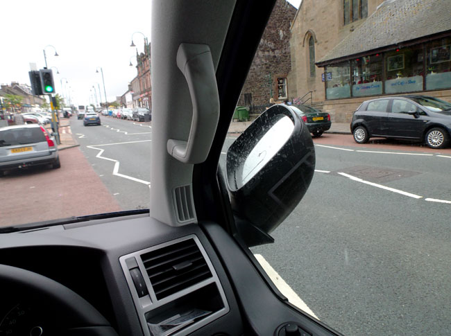
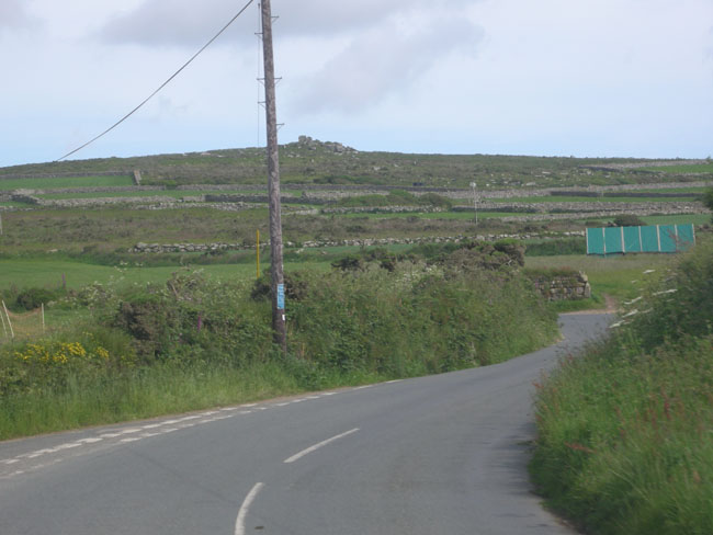
Many of the roads are narrow. Very narrow.
They have lots of history they don't want to lose by widening the roads. Thus you get many situations like this (one car waiting for the other to make it through the narrow gap): |
 |
| or this. Not obvious is that there are frequently rock walls hidden under the greenry. |
 |
| Protocol is to back up to a wide spot. |
 |
| See the carved shape for the side mirror? |
 |
| The van's side mirrors sort of tucked for parking but you couldn't do that when driving. |
 |
| This sign often showed up just before blind curves, arches over the road, buildings in the road and the like. |
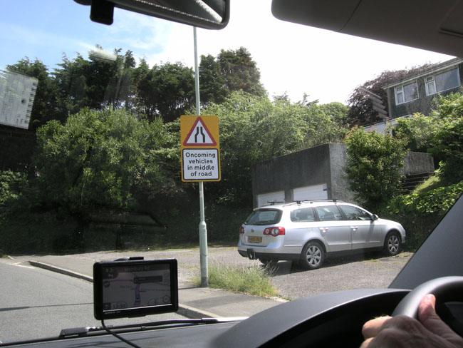 |
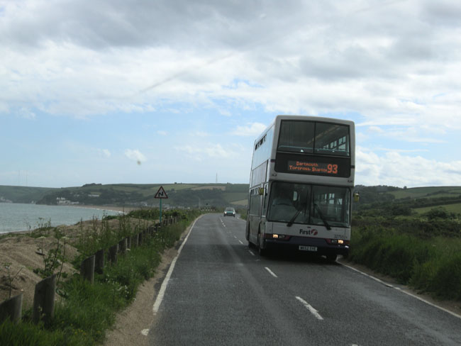
| You also watch for the disappearing dotted line which indicates the road isn't wide enough for two vehicles to pass. We learned to hold our breath and pray. |
 |
| That we didn't meet a bus |
 |
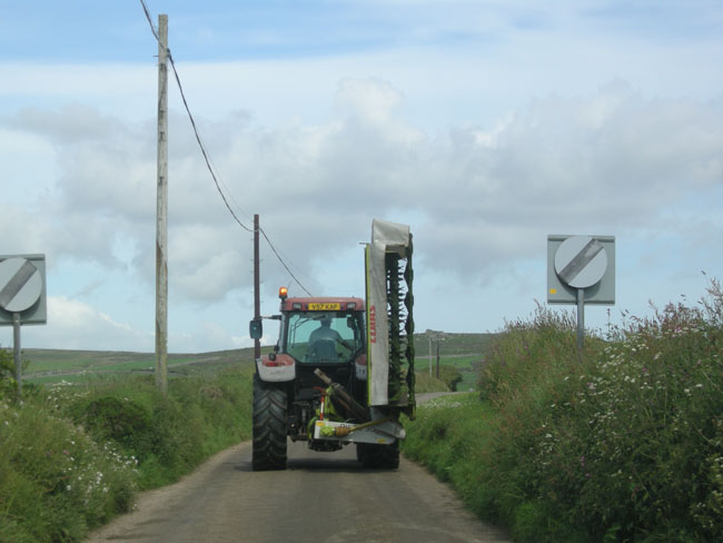
or farm equipment.
See the slashed-disk signs? They mean that the lower in-town speed limit is no longer in force, and that the national speed limit for rural roads resumes: 60 MPH. |
 |
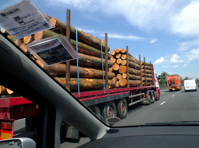
Yes, they even have logging trucks. Here on the motorway they're no problem... unfortunately we occasionally met them on the narrow twisting streets of small towns.
Let's leave Dick with his eyes glued to the road (and hands clentched tighly on the wheel) and return to scenery ... |
 |
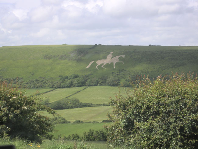
| From Corfe, we took the A352 westward. It passed one of the hill art pieces that pepper the area. This is the Osmington White Horse, created in 1808 to honor King George III (atop his favorite charger Adonis). This figure was formed by clearing vegetation and topsoil from the underlying limestone. Periodic maintainence keeps much older works visible, such as the Uffington horse we visited later. |
 |
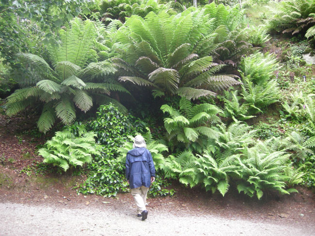
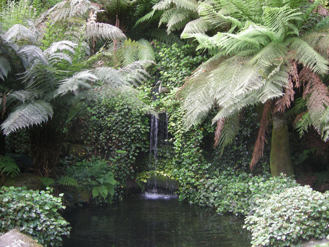
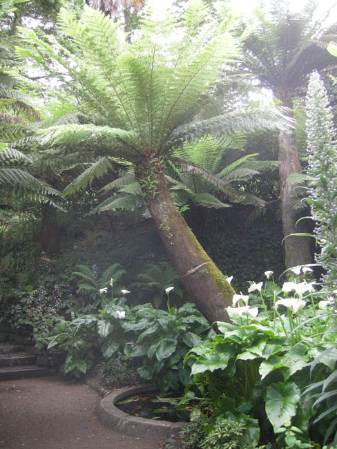
| Barely a half-mile from the southern coast, the Abbotsbury Sub-Tropical Gardens were a delight. |
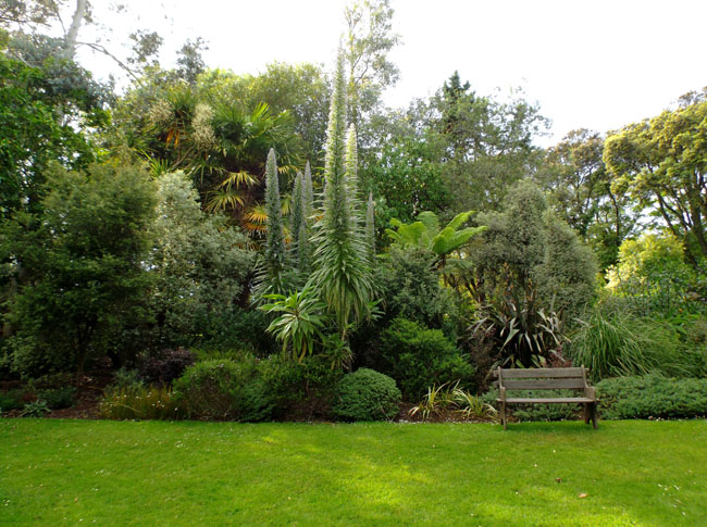 |
| Although only a 20 acre site partly pressed onto a hillside, |
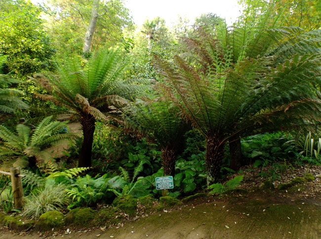 |
| the gardens featured many sub-tropical plants that survived due to the local climate niche. |
 |
| |
 |
| And thence down a vanishingly narrow road to Chesil beach |
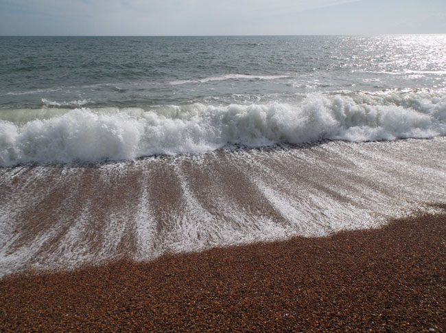 |
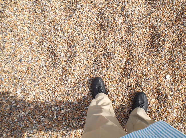
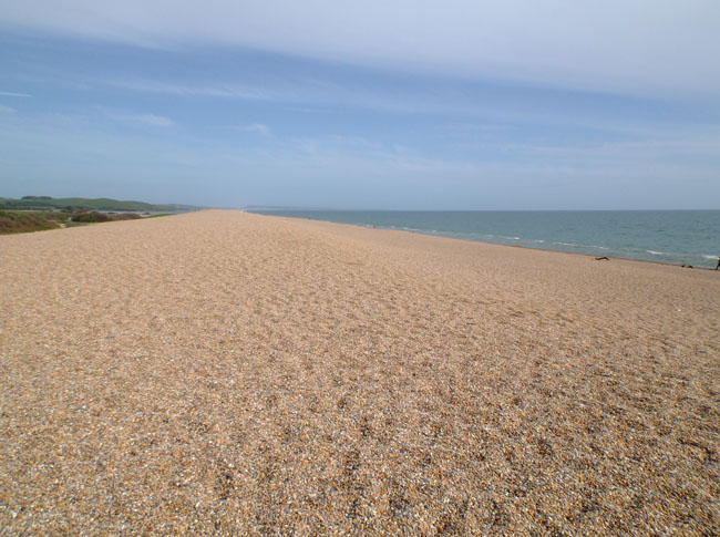
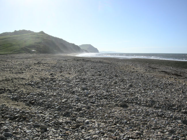
The beach isn't sand but "shingle", small rounded pebbles washed out of the collapsing chalk cliffs (see part 3). You can see and hear the strange sounds of the waves at this YouTube video. |
 |
| Chesil is an 18-mile-long barrier beach, forming the eastern end of England's Jurassic Coast. |
 |
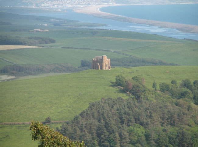
| The beach's eastern end is on Portland Island. That's the 8-mile-long Fleet Lagoon behind it. The building is the 14th century St Catherine's Chapel. |
 |
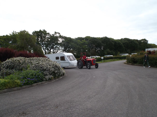
Onward to Charmouth and the Monkton Wyld Farm Caravan Park (with a spate of "Oops, missed it!" moments and SatNav-semi-directed U-turns). After setting up camp we watched a caravan being towed onto a pitch. It might have been stored in cheaper space for the winter, or perhaps it was one of the units available (like a cabin) as rentable-with-site. We later learned the difference between "touring" caravan parks (such as we sought) and "fixed" (more of a "mobile home" park).
|
 |
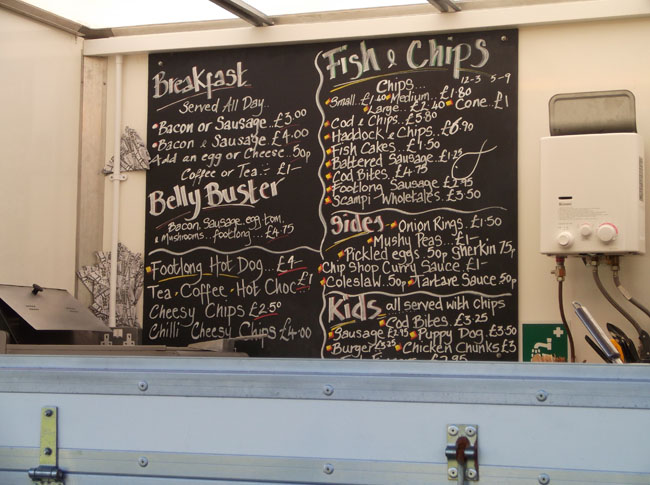
One of the many highlights of this park was a Fish & Chips trailer! Dick ordered the featured-on-sandwich-board Elvis Burger (basically a hamburger club with a spread of peanut butter), but was a bit dismayed to find the center of the burger fairly raw. |
 |
| The next morning we dropped down to the shore at Charmouth, fabled in geology and paleontology texts for the number of fossils found nearby. |
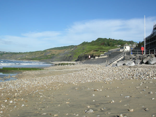 |
| Miles of cliffs, all oozing lower-Jurassic fossils onto the beach. |
 |
| Back up through the campground for coffee, then we followed the edge of Lyme Bay westward between hedgerows to ... |
 |
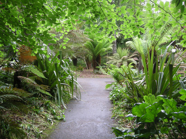
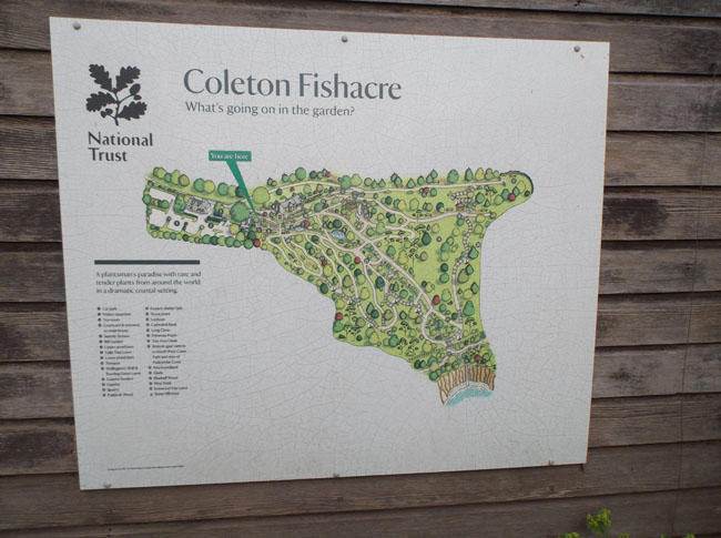
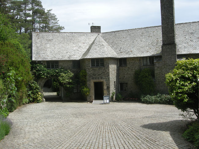
| Colton Fishacre Gardens. |
 |
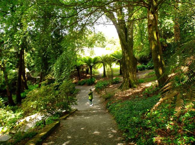
A digression on scenic and cultural sites in England: There are two primary conservation groups: the "National Trust" and "English Heritage". National Trust tends to buy or be given land (and thus the ruins that may be on it). English Heritage tends to acquire or curate historical buildings. There are many cases where National Trust owns the property, but English Heritage operates the buildings as visitable objects. Stonehenge is an example of that cooperative arrangement. Most of the sites we visited have entry fees (it costs money to maintain gardens and houses). To alleviate our cost and to avoid ticket lines, we joined the Royal Oak Society in the US, which gave us affliate status for National Trust properties. Since most of our planned destinations were out-of-doors or ruins, this was the best choice for us. It included a window sticker for our VW that gave us free parking at the sites. |
 |
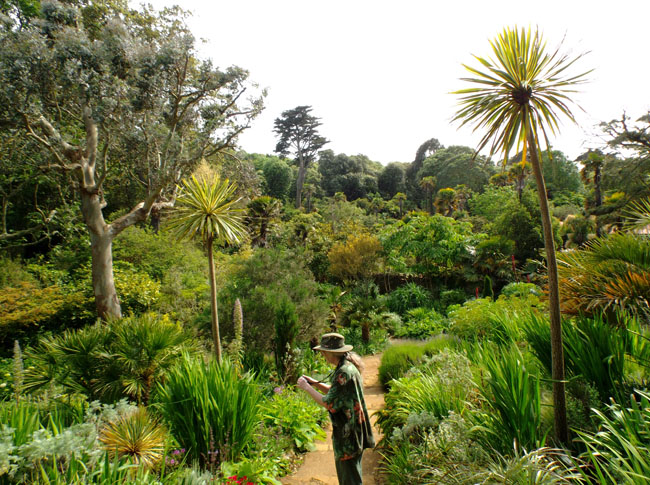
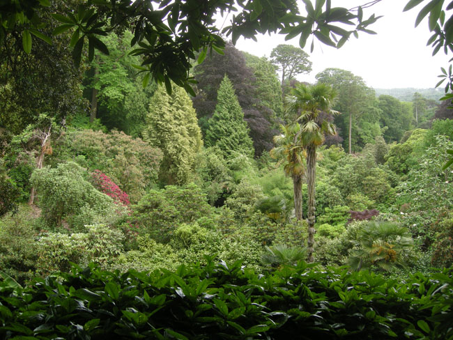
| Colton Fishacre Gardens is another site where the terrain and nearby Gulf Stream-warmed waters allow the luxurious growth of sub-tropical plantings. |
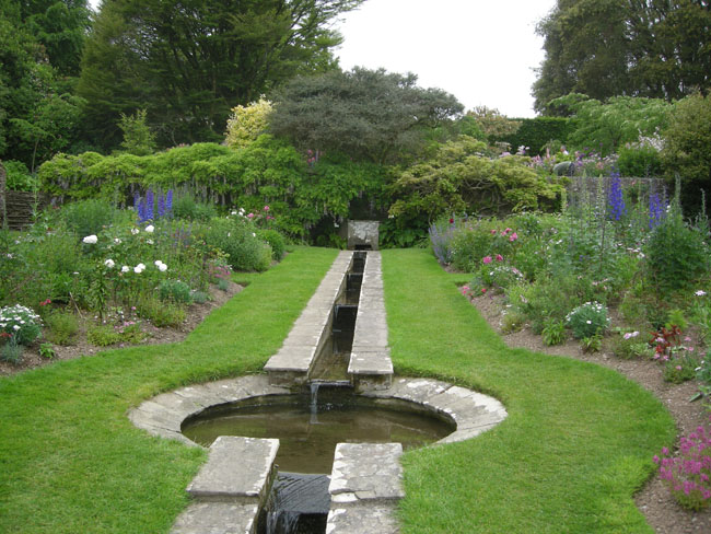 |
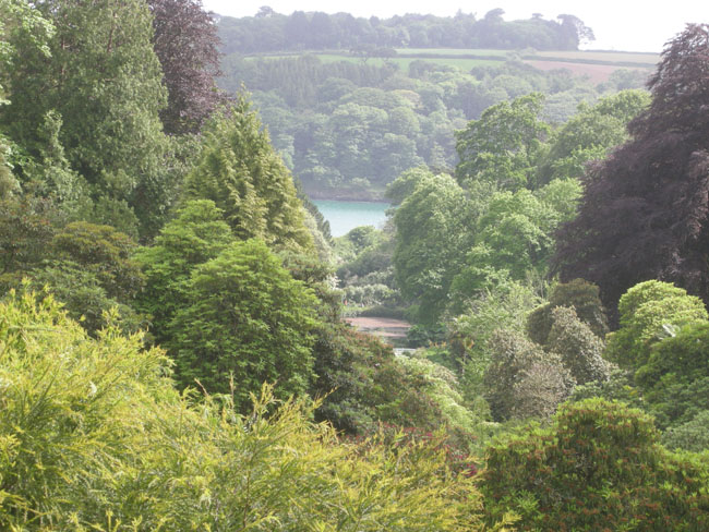
| It nestles in a steep valley, with about a 200 foot drop to the sea. |
 |
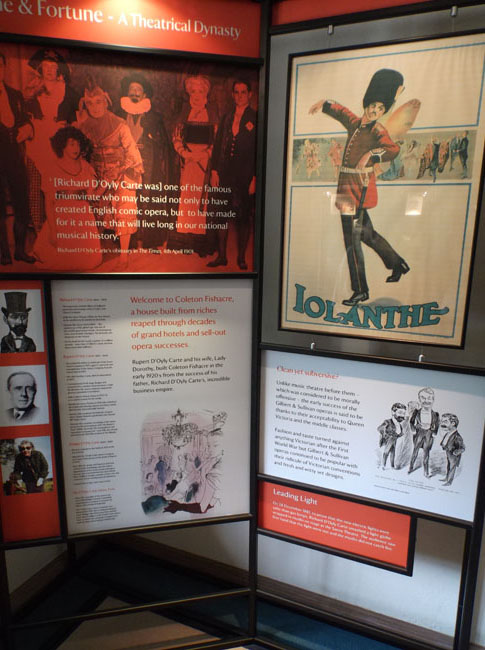
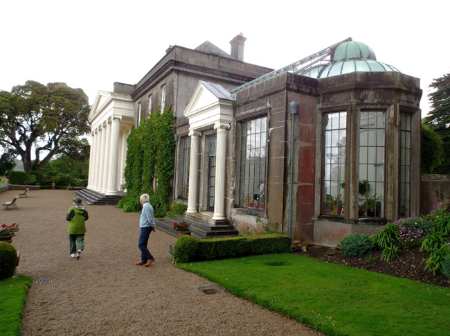
| The house on the site was built in the mid 1920's for Rupert D'Oyly Carte, famed hotelier and proprietor of the D'Oyly Carte Opera company... |
 |
| ...whose father had produced the original Gilbert and Sullivan operettas. Rupert continued the family business by bringing new productions of the "canon" to the stage after the First World War. |
 |
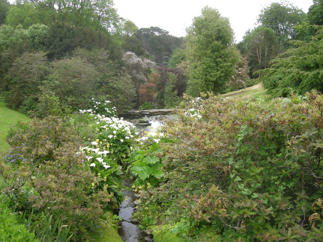
| It was raining quite hard by the time we got to the bottom of the valley that contained the garden |
 |
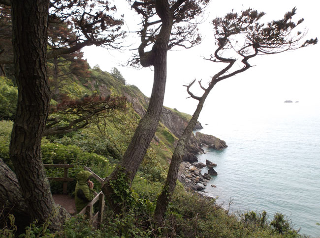
| But the lookout at the beach was worth it. |
 |
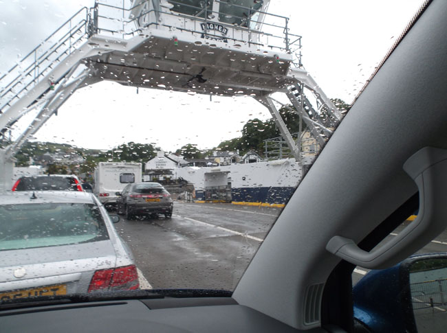
| After touring the estate, we caught a small ferry across the River Dart to Dartmouth. |
 |
Still raining. The pub off the bow has the apt name of The Floating Bridge. After disembarking in Dartmouth we squiggled up its narrow streets (brick and stone building walls jutted out to define the width of passage). |
 |
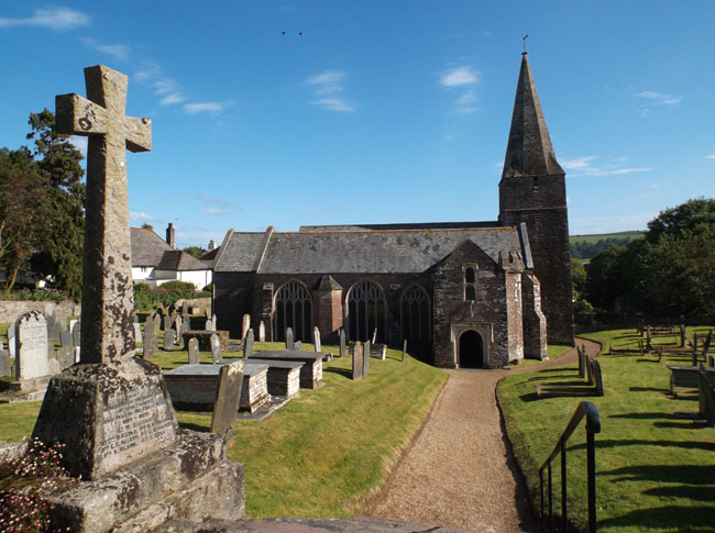
A bit south of Dartmouth we camped in rural Slapton. The afternoon weather cleared and we walked through town, hoping for an inspiring spot for dinner. The two pubs didn't open until 6:30pm, and we'd retired to the VW by then.
This is the village church surrounded by former parsons and parishioners. They (the current parishioners) have started a tea shop in the basement. |
 |
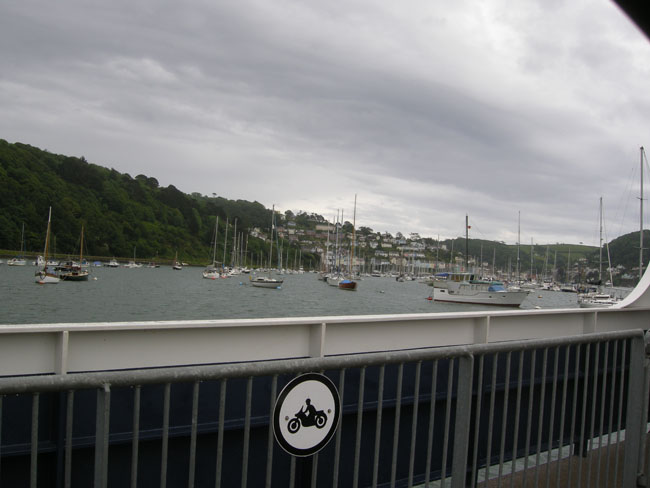
| The UK is far enough north for the tides to have quite a range. Here in the Bowcombe Estuary, near Kingsbridge, boats wait for the tide to return and refloat them. Many of the sailboats have parallel keels to serve as "feet" while they're high and dry. |
 |
| Continuing our follow-the-coast path, we next dropped down through the village of Wembury ... |
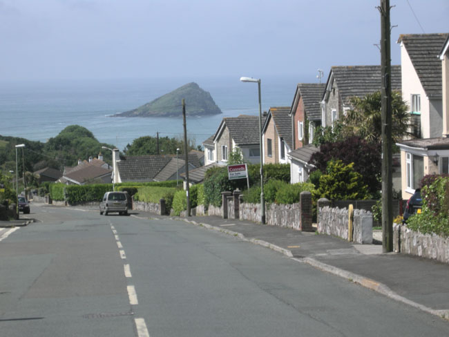 |
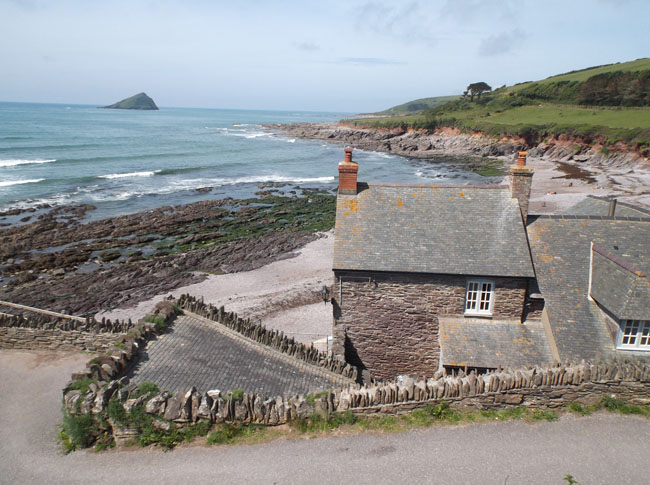
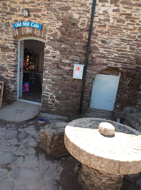
... to reach Wembury Beach, with the Mewstone in the distance.
The building was once a mill, now it's a cafe. |
 |
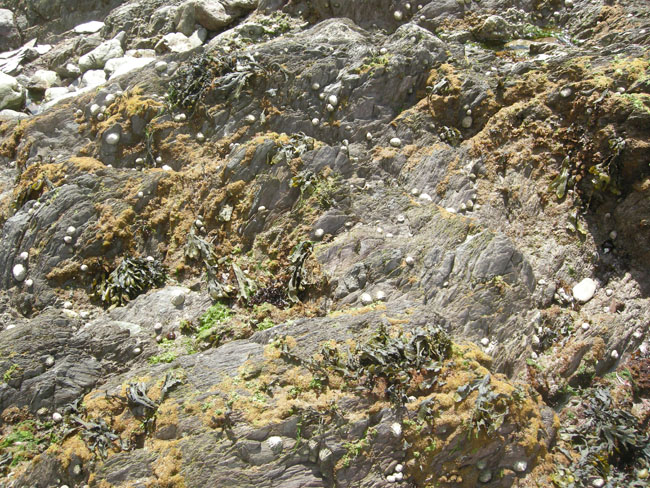
| Unlike the earlier shingled beaches, this hard-rock shore is an excellent tidepooling area. |
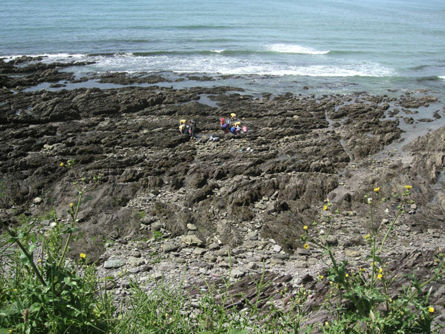 |
| Intertidal life is very similar to that of the Pacific NW at home. |
 |
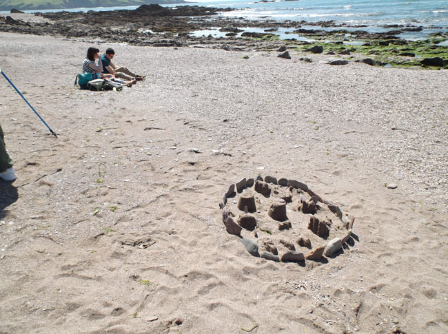
| And a sand castle ... or is it a Sandhenge? |
 |
| We had a snack at the tea shop on the beach. The old mill stones now serve as tables. |
 |
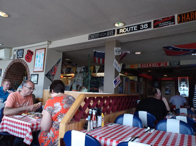
| Abandoning the coastline for the faster (and less stressful) A38, we stopped for lunch at an "American" restaurant with a "Route 66" theme. A very interesting and tasty interpretation of US food. |
 |
|
|
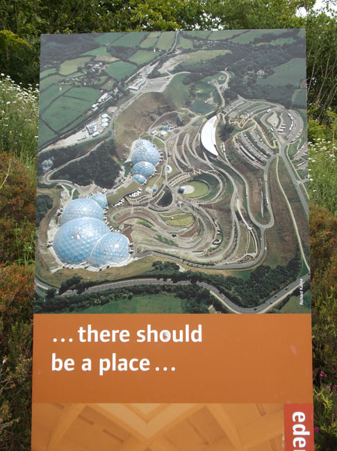 |
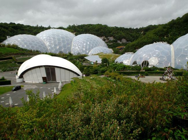
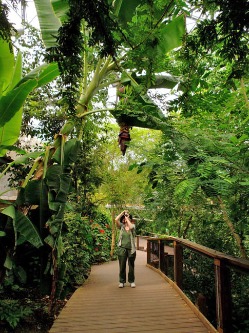
And it's called the Eden Project, heralding our arrival in Cornwall.
A slick way to part plant-lovers and concert-goers from their money in the name of environmental educational outreach (and they have good ice cream).
The biggest four domes in the rear house "biomes"... different climatic zones allowing the growth and display of plants from around the world. It really is thoughtfully laid out and well-presented.
Some of the domes are exhibit spaces, one includes the restaurant and another has (surprise) the gift shop. |
 |
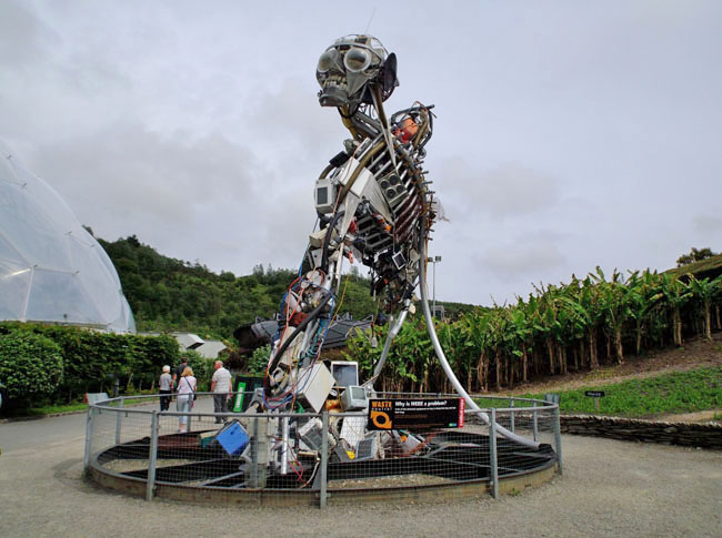
| The Waste Monster sculpture, one of many art pieces on the site. |
 |
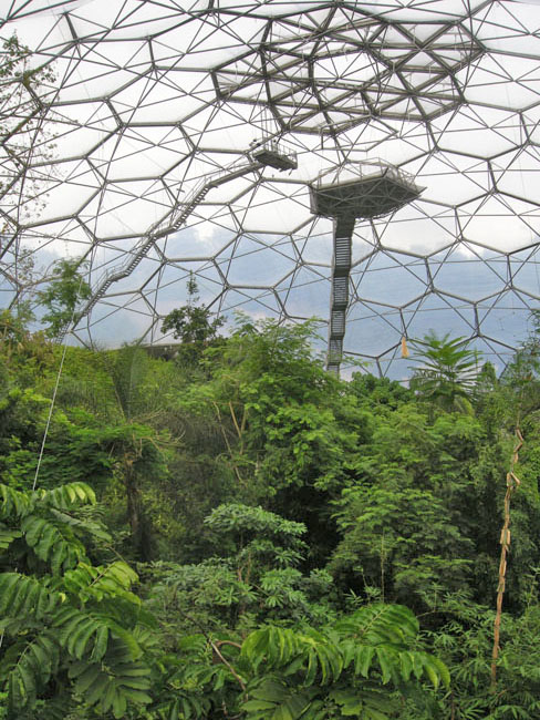
| The paths wandered around the floors of the domes, up the rear hillslopes, across tree-canopy bridges, and, for the truly adventurous, you could go higher still (but that level was closed during our visit). |
 |
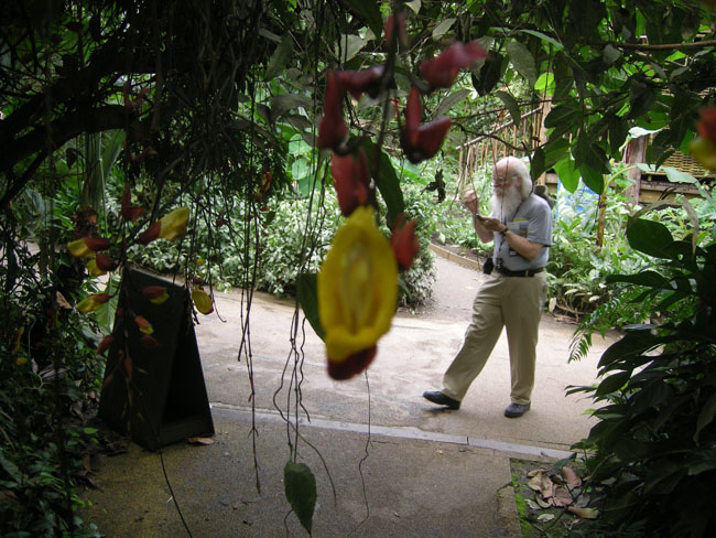
| The Mysore Trumpet Vine (not wearing a camera). |
 |
| Karen shoots a banana |
 |
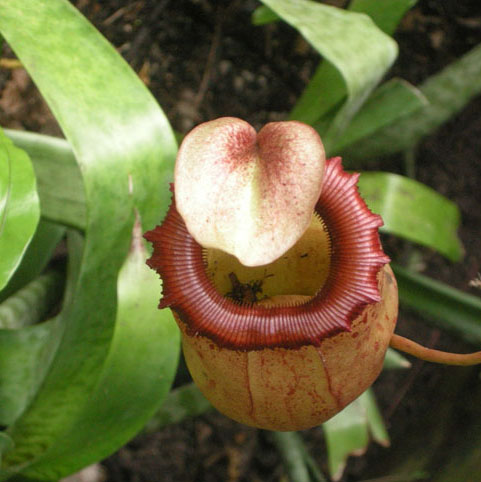
| Huge tropical pitcher plant |
 |
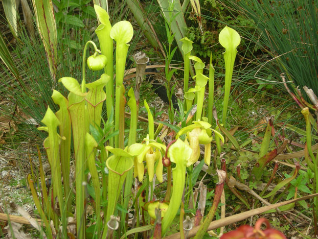
| And a wonderful outdoor display of carnivorous plants too |
 |
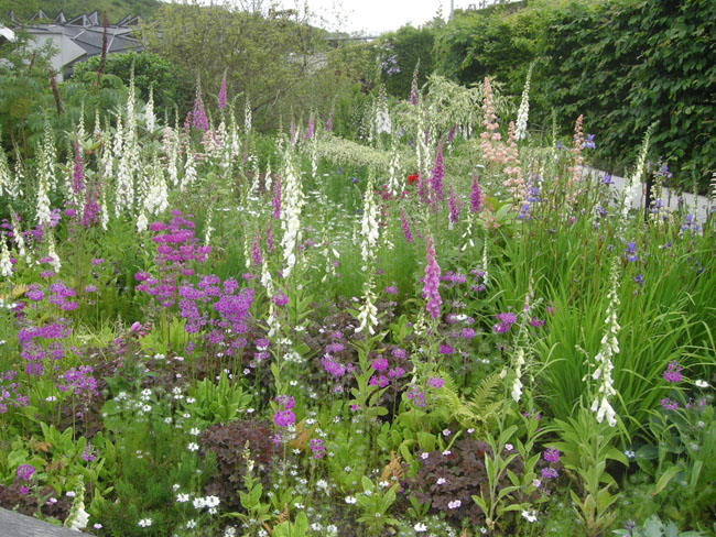
| And of course what we think of as typical English garden plants too. |
 |
| They kicked us out the door of Eden so they could go home for the night, so we wandered off to a typically crowded campground at Veryan. |
 |
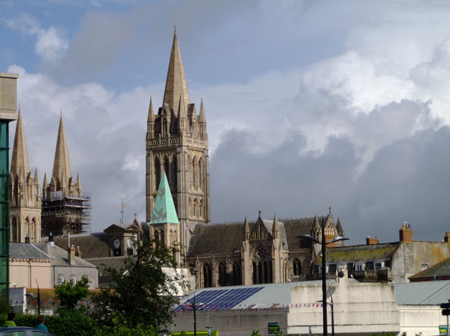
| Quickly through Truro (since we mislaid the ferry that would have avoided it) on our way to ... |
 |
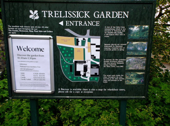
| ... the Trelissick Gardens |
 |
|
Another steep valley estate with all sorts of plants crammed in. |
 |
Yes, there were tree ferns.
(If you fern it, Karen will come) |
 |
| And trees |
 |
| And a tower of climbing hydrangea |
 |
| The house, in whose orangey we sat out a brief shower, is still being renovated and not yet on daily display. |
 |
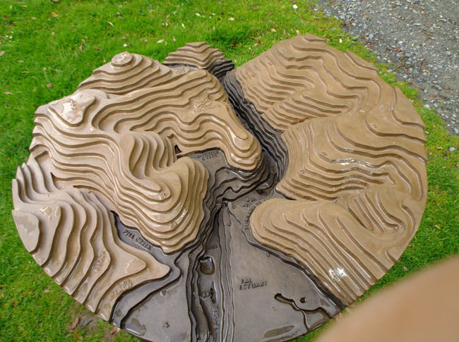
| The gardens had a view of the line for the ferry we had intended to take if we hadn't been taken on a tour by the GPS. |
 |
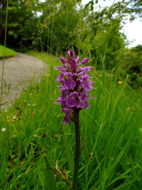
| In the uncut grass they had orchids. |
 |
| On the way to the next garden we stopped at our first pub for lunch. It wouldn't be the last. The food was very good. It was called the New Pub, just above Falmouth. New as of the 1720s or so. The regulars were "assisting" the pub owner who was mounting a big screen TV to get ready for England's first game in the world cup that night. |
 |
| Trebah Gardens was one of Karen's favorites. Everywhere there was a bench you knew you were going to be given a remarkable vista. |
 |
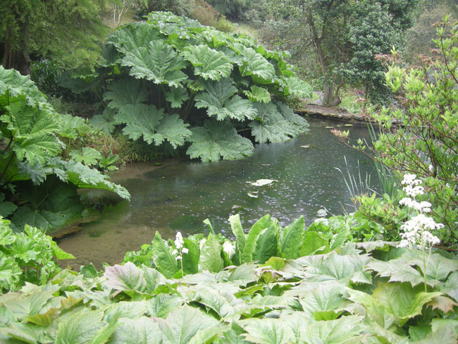
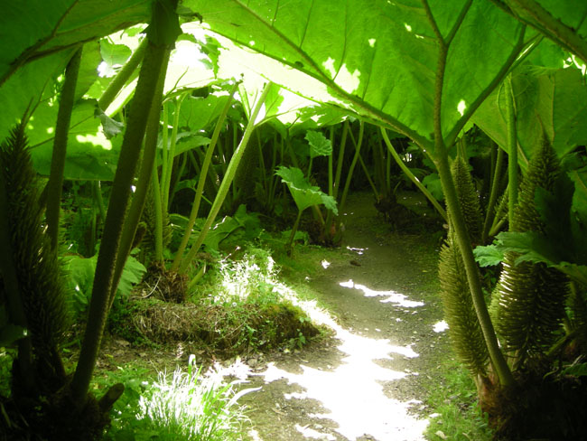
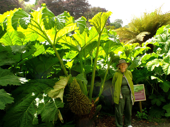
| There was a path through the Gunnera: This water-loving relative of rhubarb was growing higher than our heads. |
 |
| The view from the beach |
 |
| And from the top |
 |
| And places in between |
 |
| |
 |
| |
 |
| Adjacent Glendurgen Garden was being brought back from neglect. |
 |
| It too had Gunnera but not near the spectacular vistas of Trebah. |
 |
| But it had ancient tree ferns |
 |
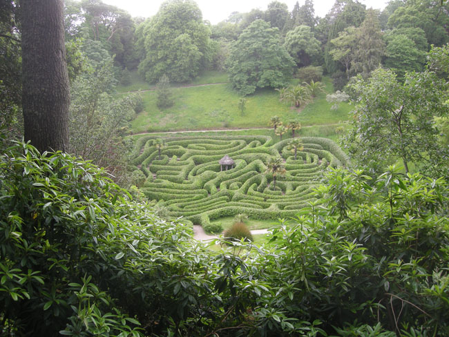
| And a lovely maze. |
 |
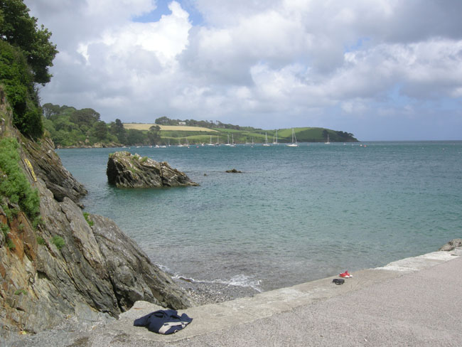
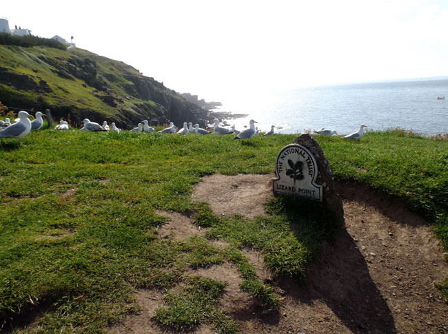
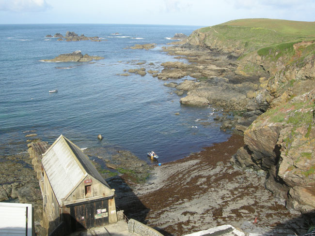
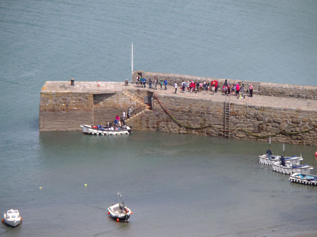
The next morning took us to Lizard Point, the southernmost point of the British mainland.
|
 |
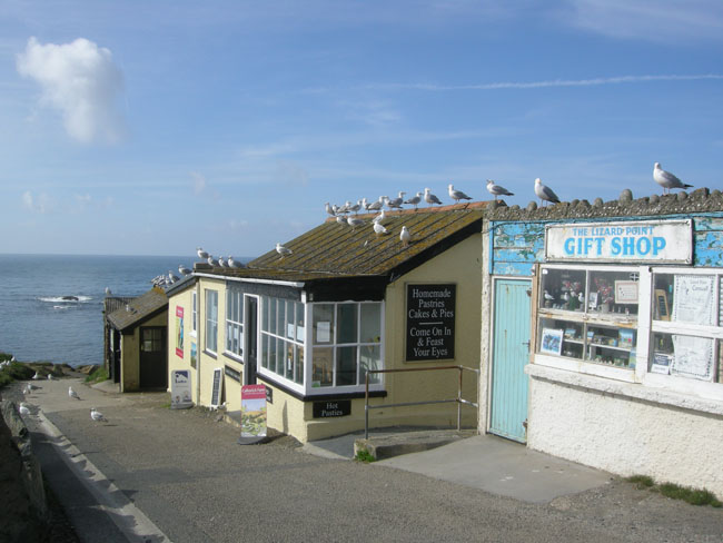
| It had a gift shop, a tea shop, and a museum about Marconi's early radio experiments and telegraph station... all closed since we were too early. |
 |
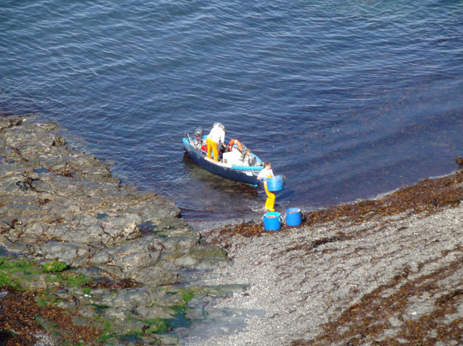
| Behind the buildings was the rocky shore and shallows. |
 |
| Where we watched a pair of fishermen bring in their catch. |
 |
| |
 |
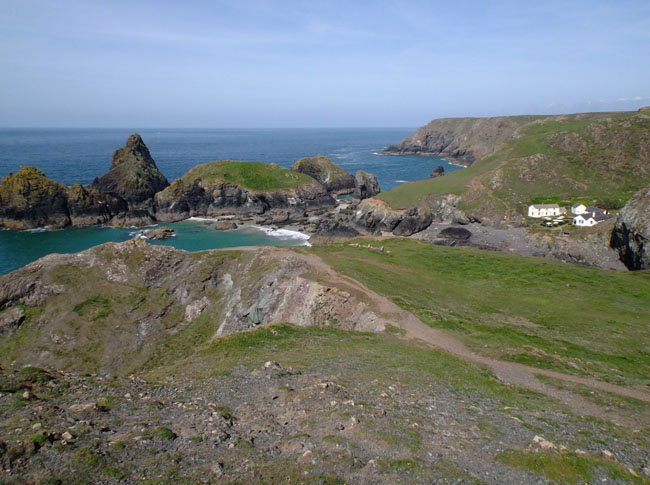
| Around the corner was beautiful Kynance Cove. |
 |
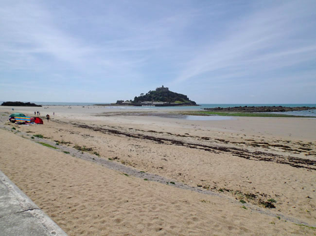
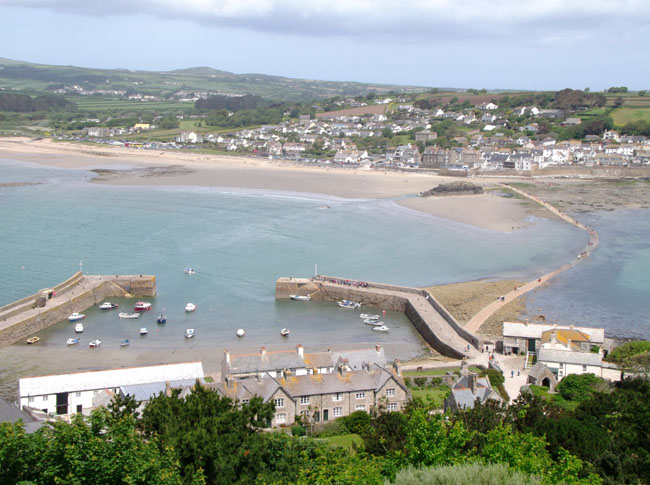
| Heading further west on the tip of Cornwall, we reached St Michael's Mount. Like France's Mont Saint-Michel, it's reached by walking out a causeway at low tide. |
 |
| Once there, we walked through a tiny town and clambered up the hill... |
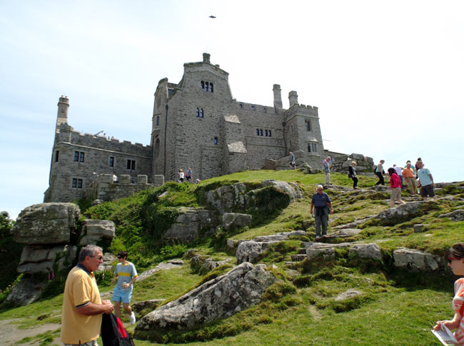 |
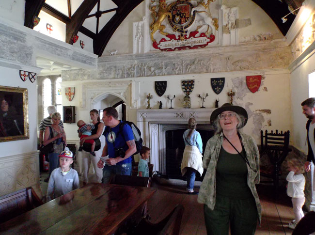
| ... to explore some of the still-occupied castle at the top. |
 |
| |
 |
| Its own chapel |
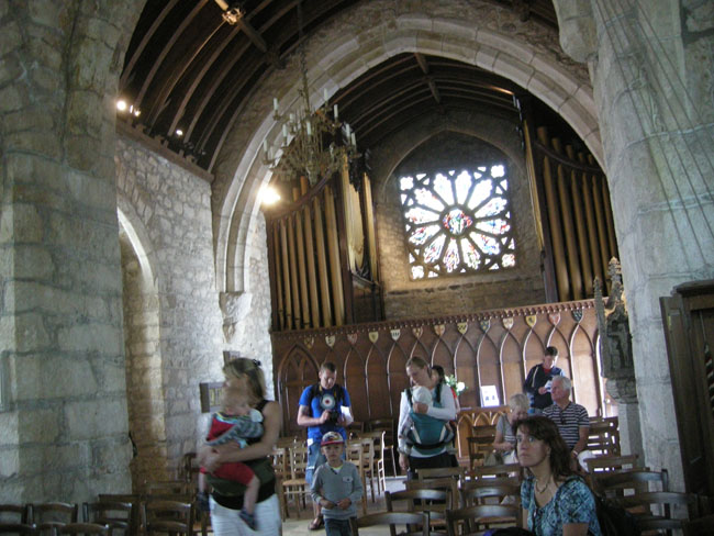 |
| with stained glass |
 |
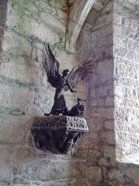
| And statue of its namesake St Michael overcoming the devil |
 |
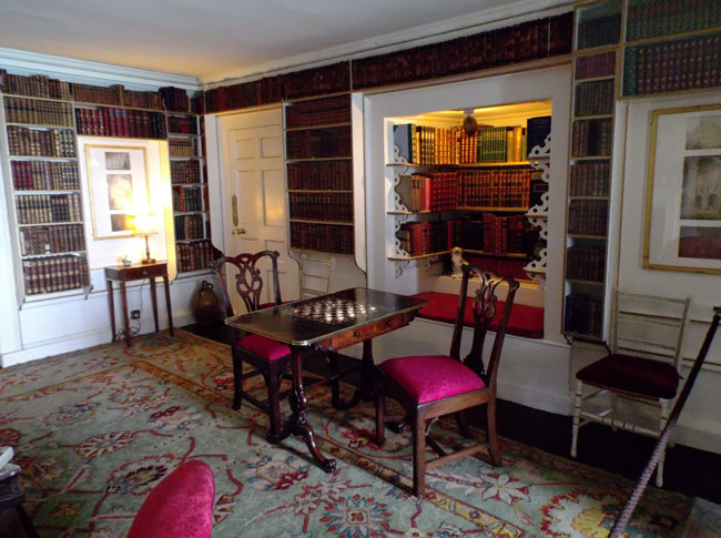
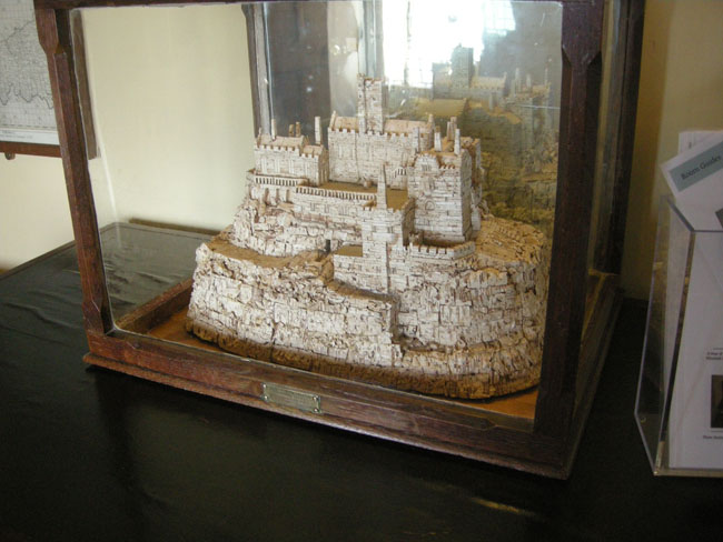
| One of the servants made a model made out of wine corks. I wonder if time may drag a bit out at the edge like this. |
 |
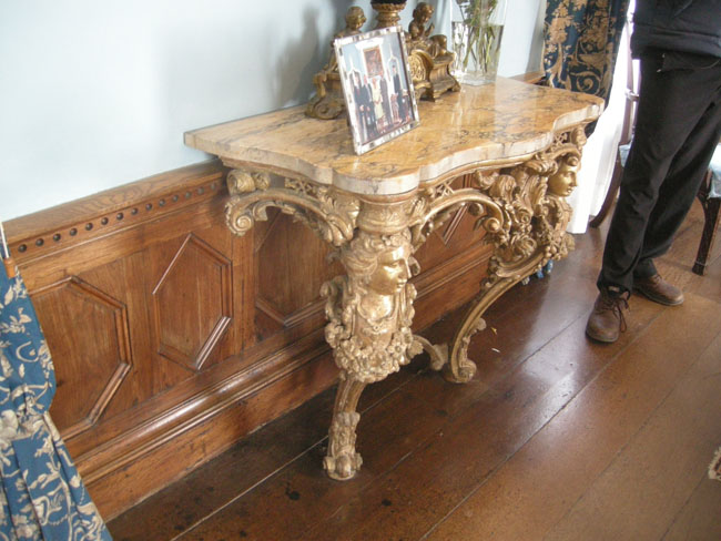
| Amazing carved wood |
 |
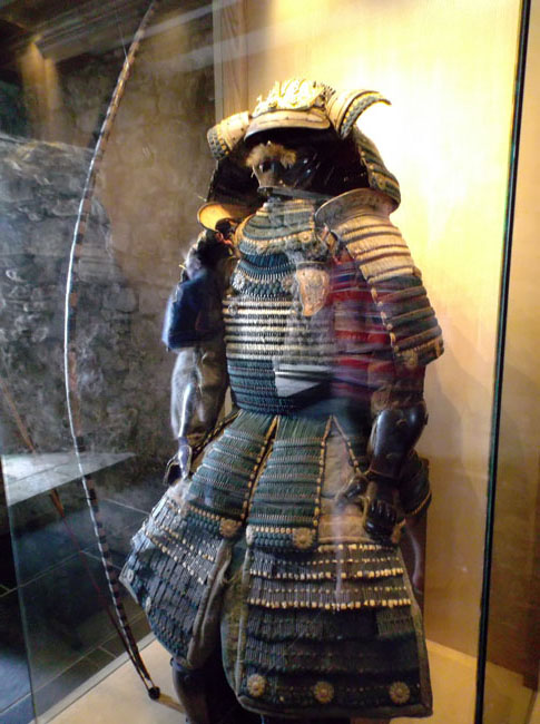
| A small museum of arms |
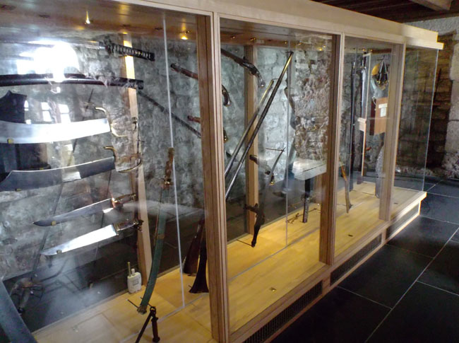 |
| and armor |
 |
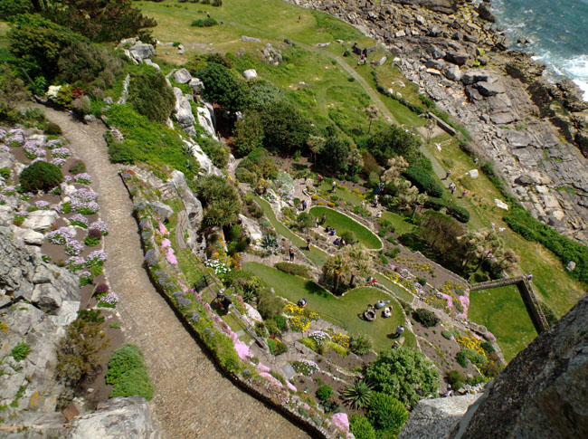
| The gardens were designed to be viewed from above |
 |
| We also saw that the tide had returned and people were having to wade the causeway |
 |
| Or take the boat. Which is what we did. |
 |
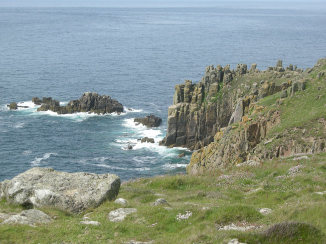
| The next point over is Land's End, the most western part of the main island. This leads to boasts like those of this Inn. |
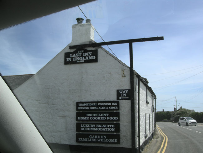 |
| The Inn in the previous photo didn't really lie because the building at the actual point is a full-blown hotel instead of an inn. |
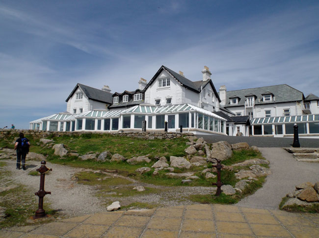 |
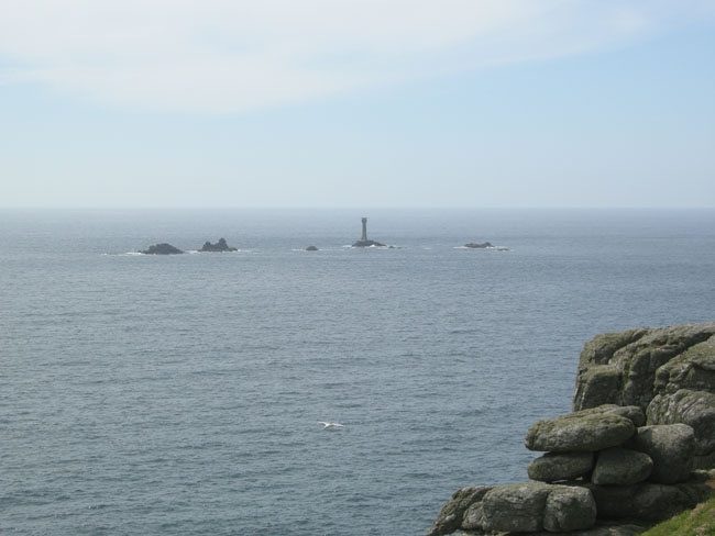
| The view |
 |
| |
 |
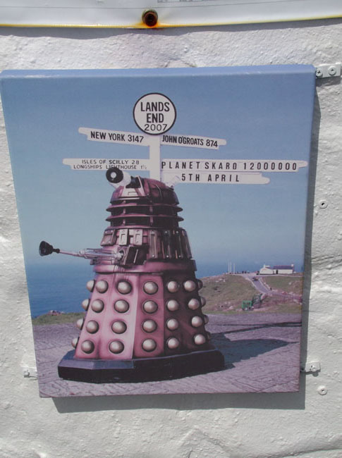
| The hype |
 |
| The craft village we didn't hike over to. |
 |
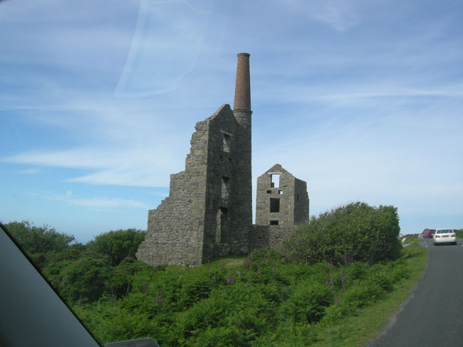
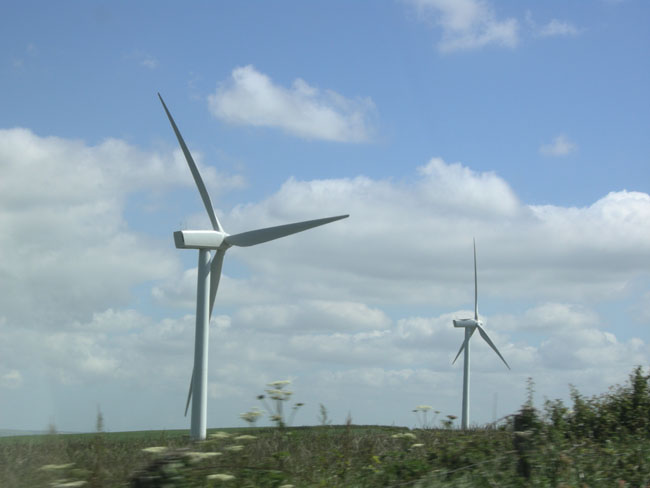
We headed back along the northwest coast of Cornwall. All along the roads here we would see old mining ruins like this. Some ran shafts out under the ocean in search of tin. |
 |
| Now they're mining the skies.. (again). |
 |
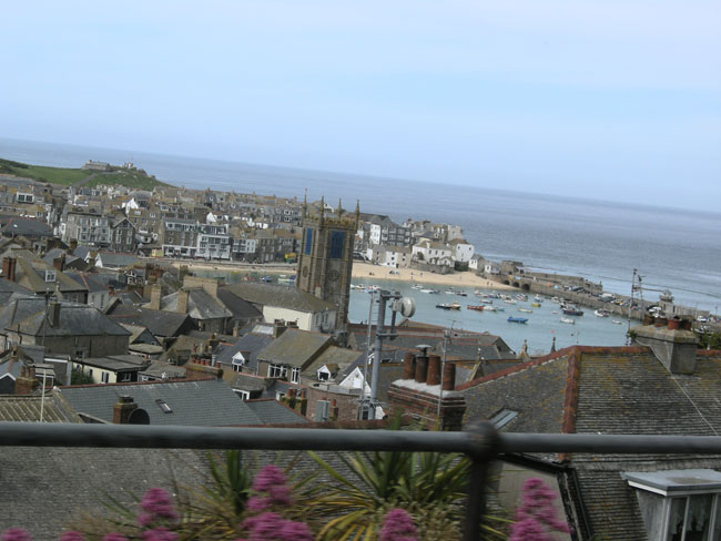
| We camped just north of the picturesque Cornish coastal town of St Ives. |
 |
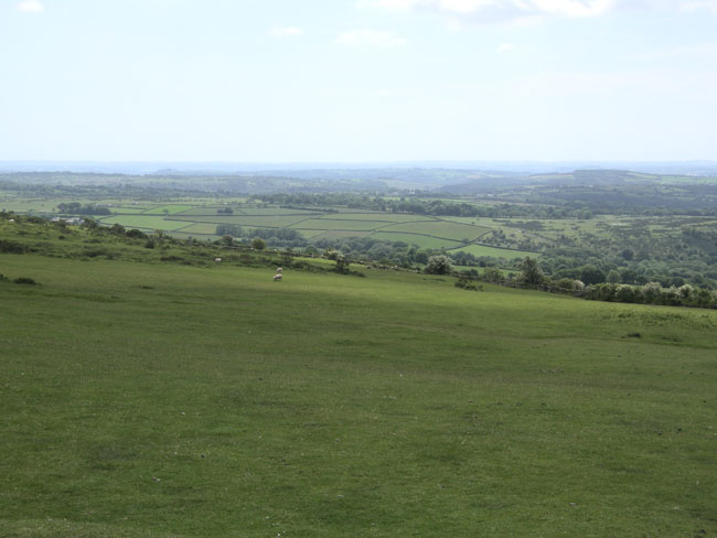
In the morning we turned back inland to explore Dartmoor.
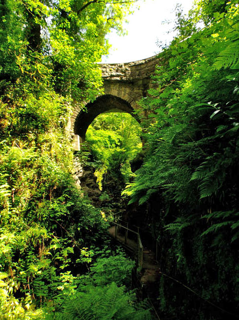
Our first stop was Lydford gorge. |
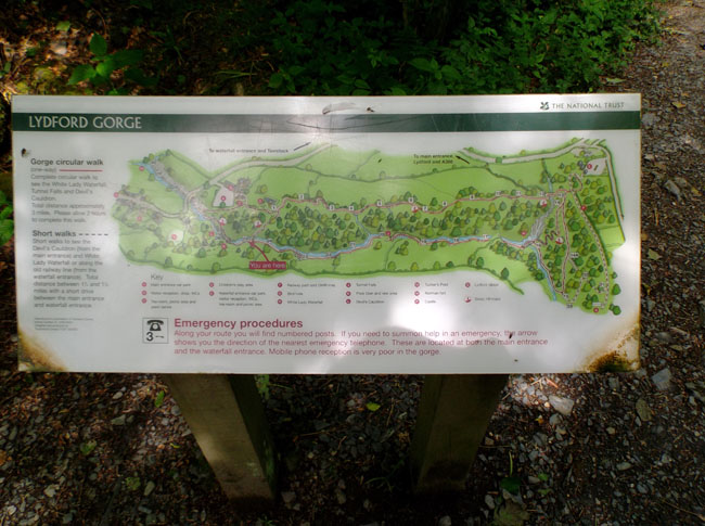 |
Visiting the gorge starts as a pleasant woodlands walk... |
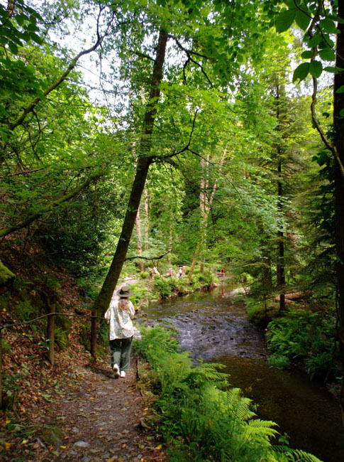 |
| ... which leads to the deepest gorge in England's southwest. |
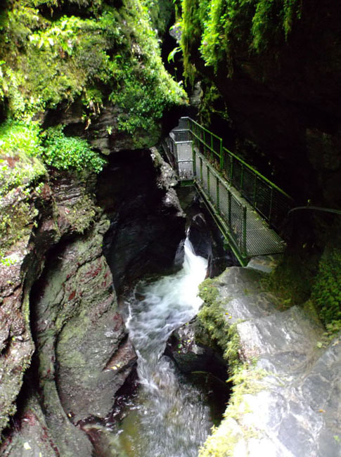
 |
| which contained Devil's Cauldron and a 90 foot cascade/waterfall. |
 |
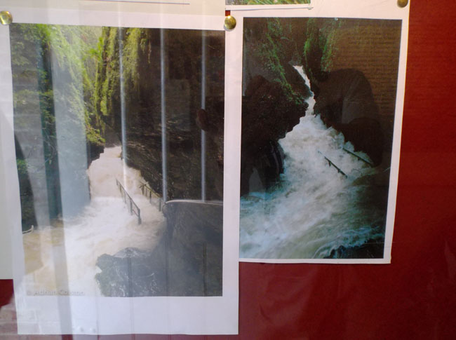
| The storms in 2014's spring floods had the walkway underwater. |
 |
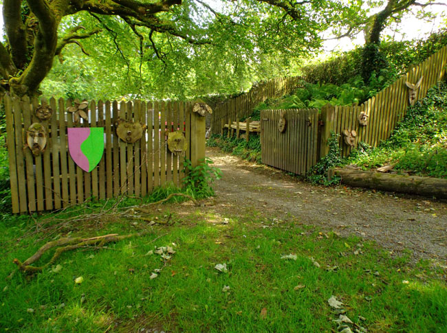
| The property's work area was festooned by fun art -- probably the result of some of their classes. There seemed to be lots of community activities offered. |
 |
| Coming back out of the gorge we passed Lydford Castle, known for its "justice" or rather lack thereof. |
 |
| The area's patchwork fields came to an end ... |
 |
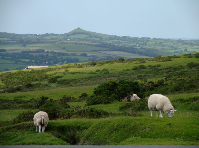
| and we're into Dartmoor National Park |
 |
| ... still with sheep ... |
 |
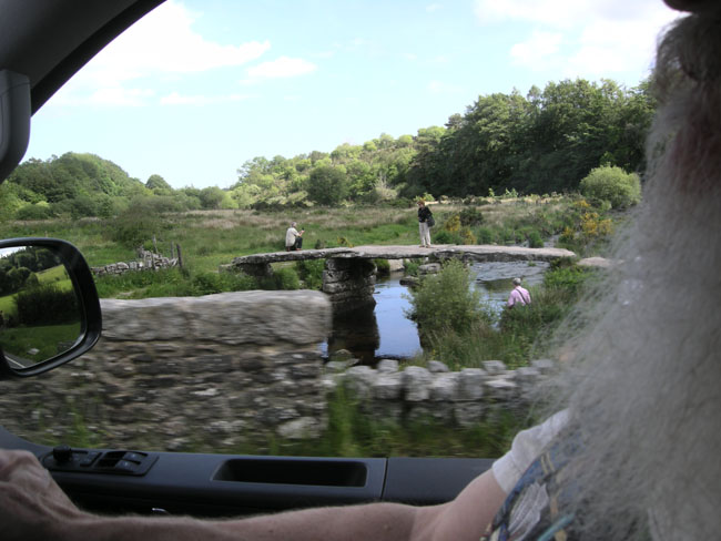
| an ancient "clapper" bridge |
 |
| open grazing |
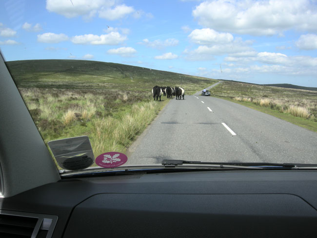 |
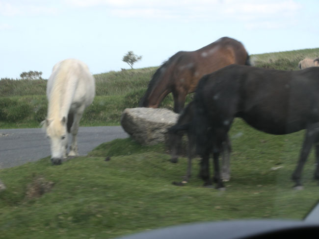
| The famous Dartmoor ponies. |
 |
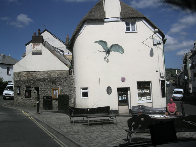
| Sometimes you get glimpses of the strange as you drive past: sculpture of flying monster? griffin? on side of building |
 |
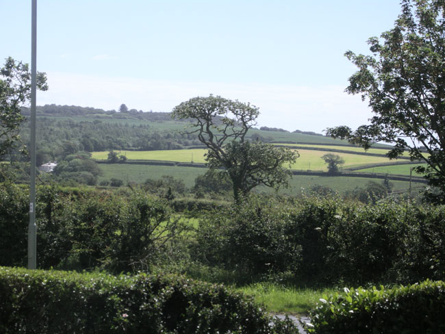
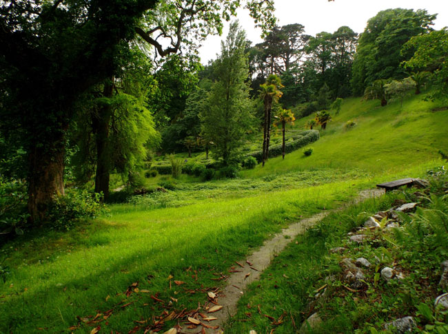
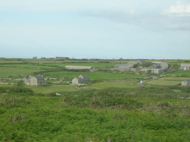
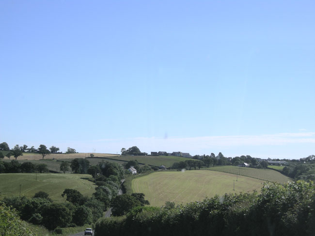
Down off the moor and once more into patchworked fields (and hedgerows). |
 |